The Zyel Publishing map room

See where the story happens.

Every map subject on the current shelf now has an open satellite orientation companion. The imagery shows terrain and distance; the books' authored maps carry the historical argument.

33satellite maps
5books covered
1open source layer

Two layers, two jobs

Terrain for orientation. Historical claims kept visibly separate.

Modern satellite imagery cannot prove a medieval road, ancient frontier, historical vegetation pattern, or political boundary. Each route is labeled as schematic, strategic, reconstructed, approximate, or tied to documented waypoints; travel notes state what the distance does and does not tell us.

Book 01 · 6 orientation maps

The Complete Procopius

6 authored map subjects, each paired with a modern terrain view.

01

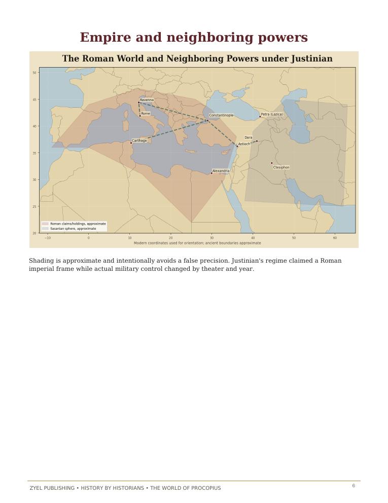
Empire and neighboring powers

Authored historical map: Empire and neighboring powers
Authored historical map
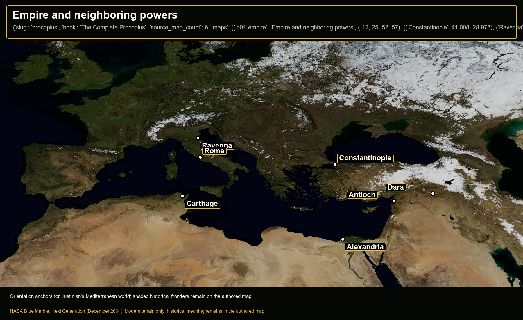
Open NASA satellite orientation map: Empire and neighboring powers
Open satellite orientation

Orientation anchors for Justinian's Mediterranean world; shaded historical frontiers remain on the authored map.

Places
Constantinople · Ravenna · Rome · Carthage · Antioch · Alexandria · Dara
Crop
-12, 25, 52, 57 (west, south, east, north)
02

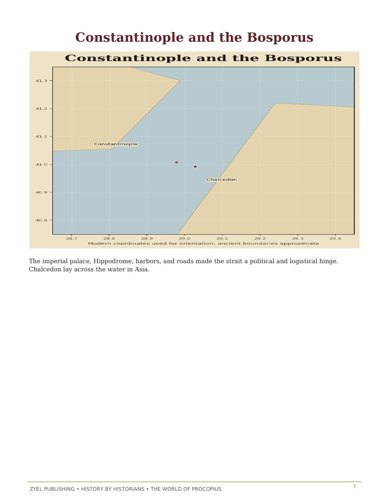
Constantinople and the Bosporus

Authored historical map: Constantinople and the Bosporus
Authored historical map
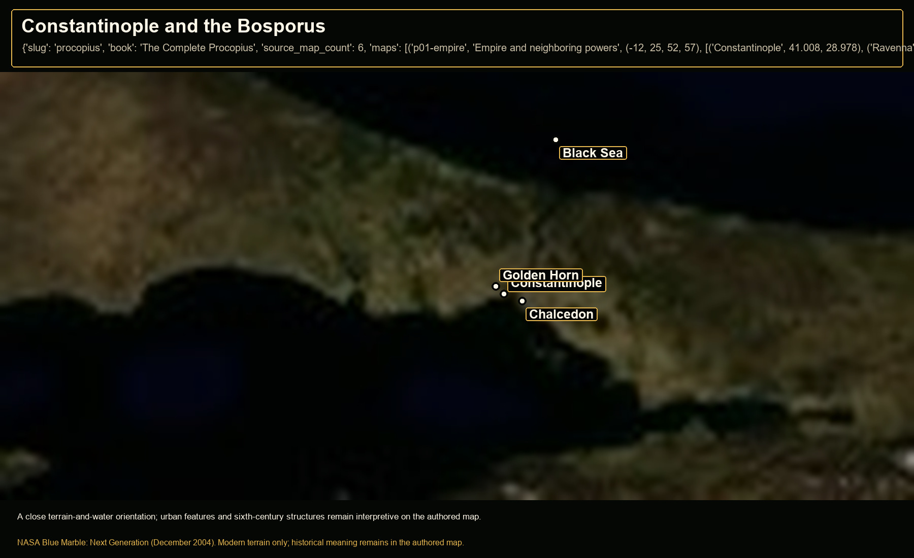
Open NASA satellite orientation map: Constantinople and the Bosporus
Open satellite orientation

A close terrain-and-water orientation; urban features and sixth-century structures remain interpretive on the authored map.

Places
Constantinople · Chalcedon · Golden Horn · Black Sea
Crop
27.6, 40.55, 30.1, 41.5 (west, south, east, north)
03

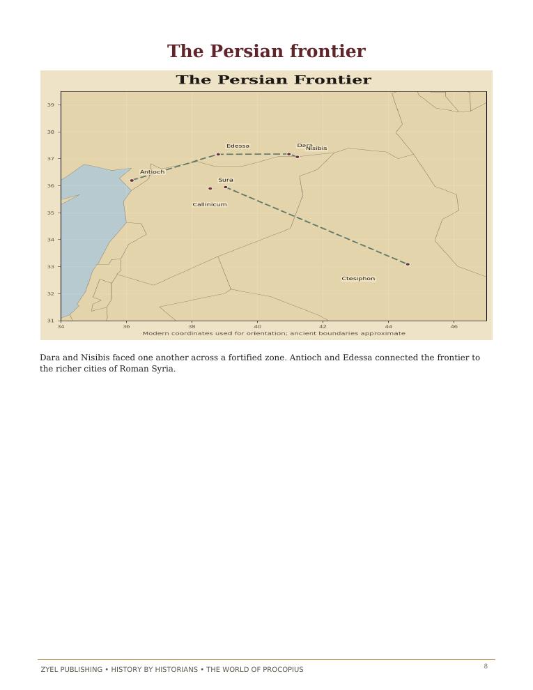
The Persian frontier

Authored historical map: The Persian frontier
Authored historical map
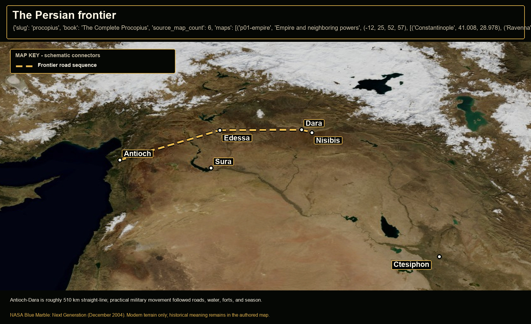
Open NASA satellite orientation map: The Persian frontier
Open satellite orientation

Antioch-Dara is roughly 510 km straight-line; practical military movement followed roads, water, forts, and season.

Places
Antioch · Edessa · Dara · Nisibis · Sura · Ctesiphon
Route status
Frontier road sequence: schematic operational connection
Crop
33, 32, 47, 40 (west, south, east, north)
04

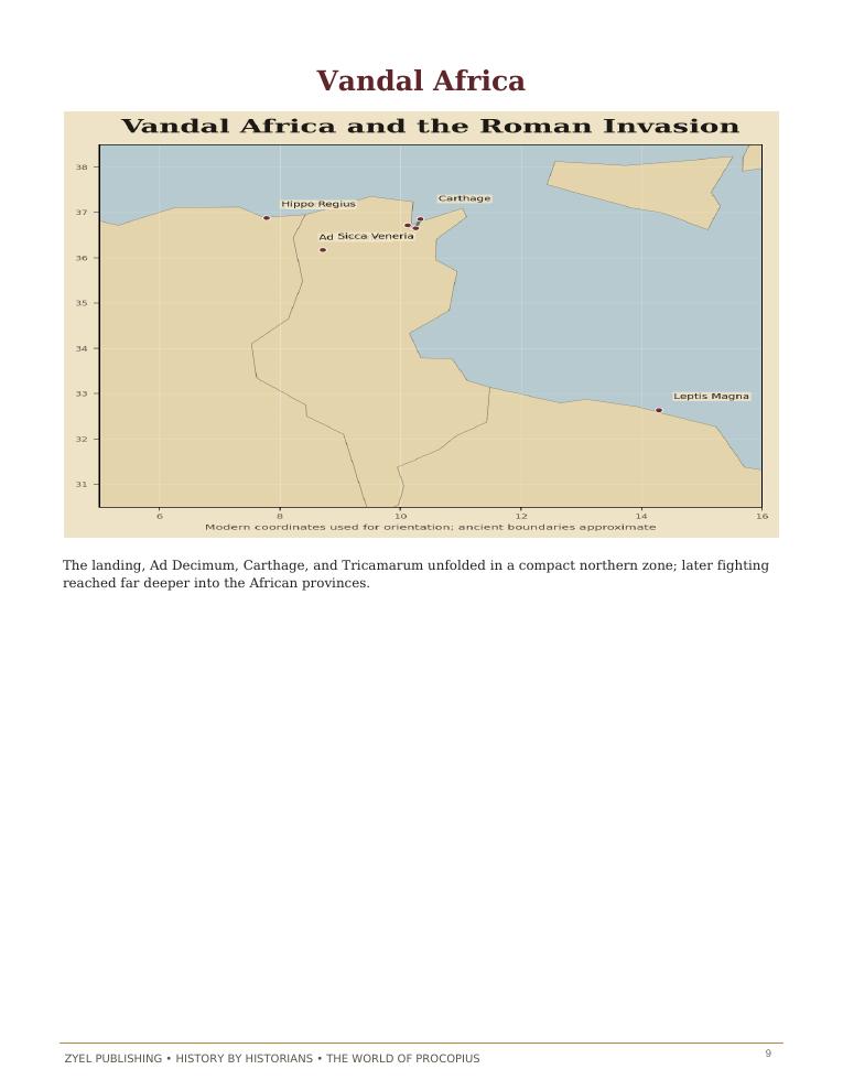
Vandal Africa

Authored historical map: Vandal Africa
Authored historical map
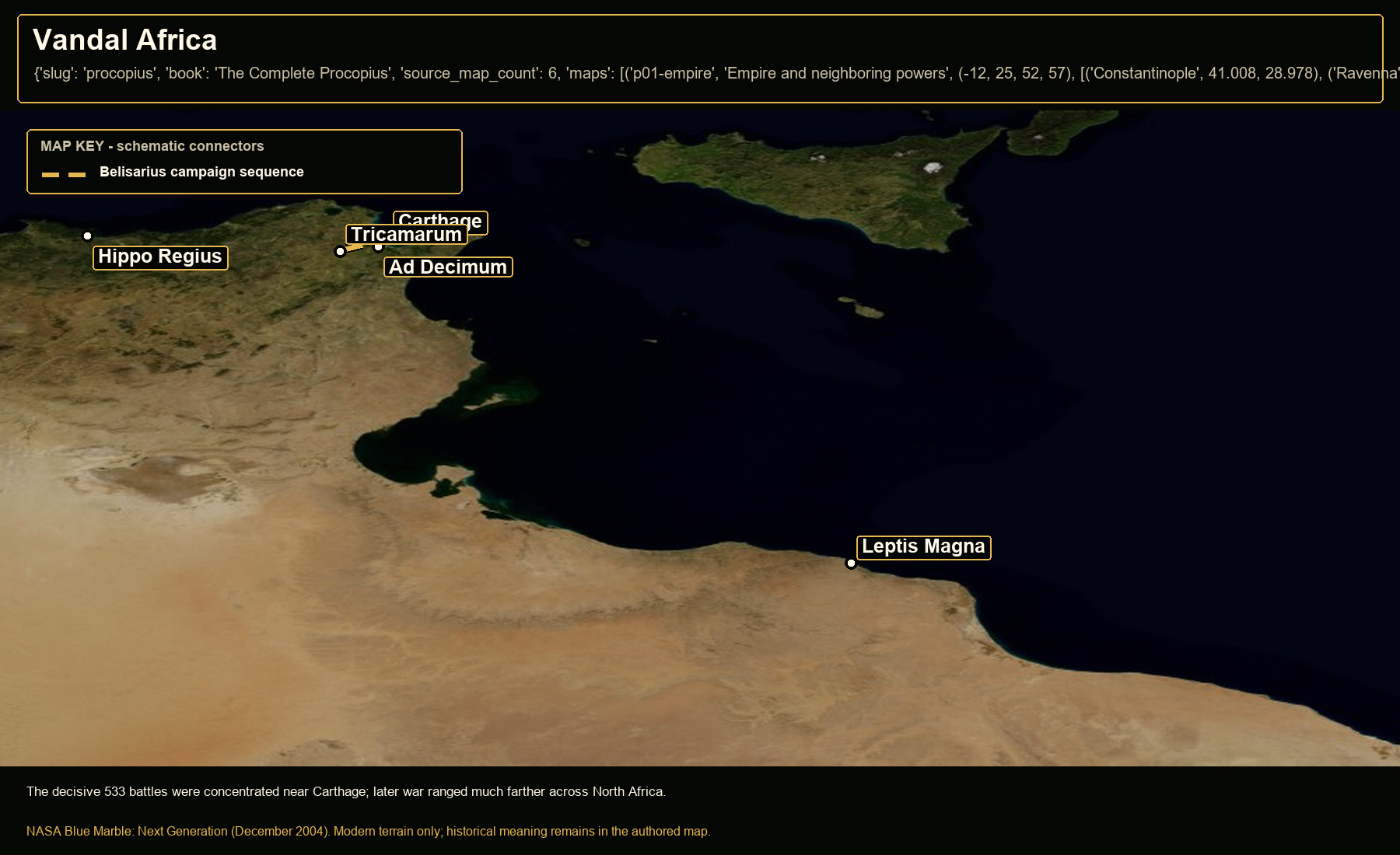
Open NASA satellite orientation map: Vandal Africa
Open satellite orientation

The decisive 533 battles were concentrated near Carthage; later war ranged much farther across North Africa.

Places
Carthage · Ad Decimum · Tricamarum · Hippo Regius · Leptis Magna
Route status
Belisarius campaign sequence: attested sequence; schematic connectors
Crop
7, 30, 19, 38.5 (west, south, east, north)
05

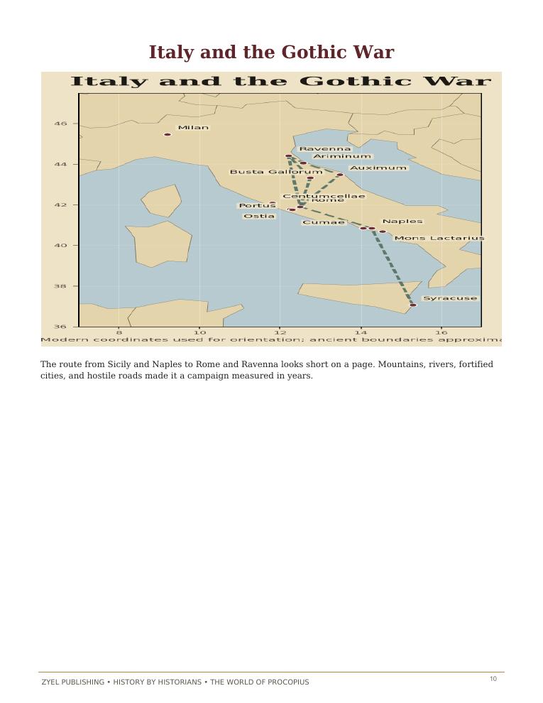
Italy and the Gothic War

Authored historical map: Italy and the Gothic War
Authored historical map
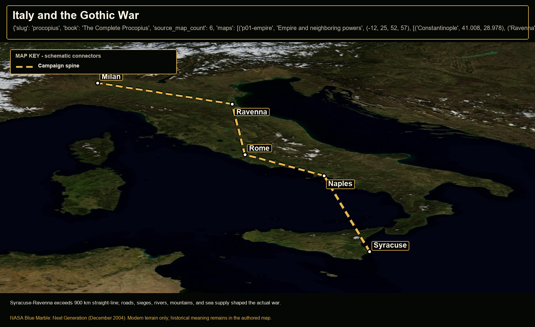
Open NASA satellite orientation map: Italy and the Gothic War
Open satellite orientation

Syracuse-Ravenna exceeds 900 km straight-line; roads, sieges, rivers, mountains, and sea supply shaped the actual war.

Places
Syracuse · Naples · Rome · Ravenna · Milan
Route status
Campaign spine: attested theaters; schematic connector
Crop
7, 35, 19, 47.5 (west, south, east, north)
06

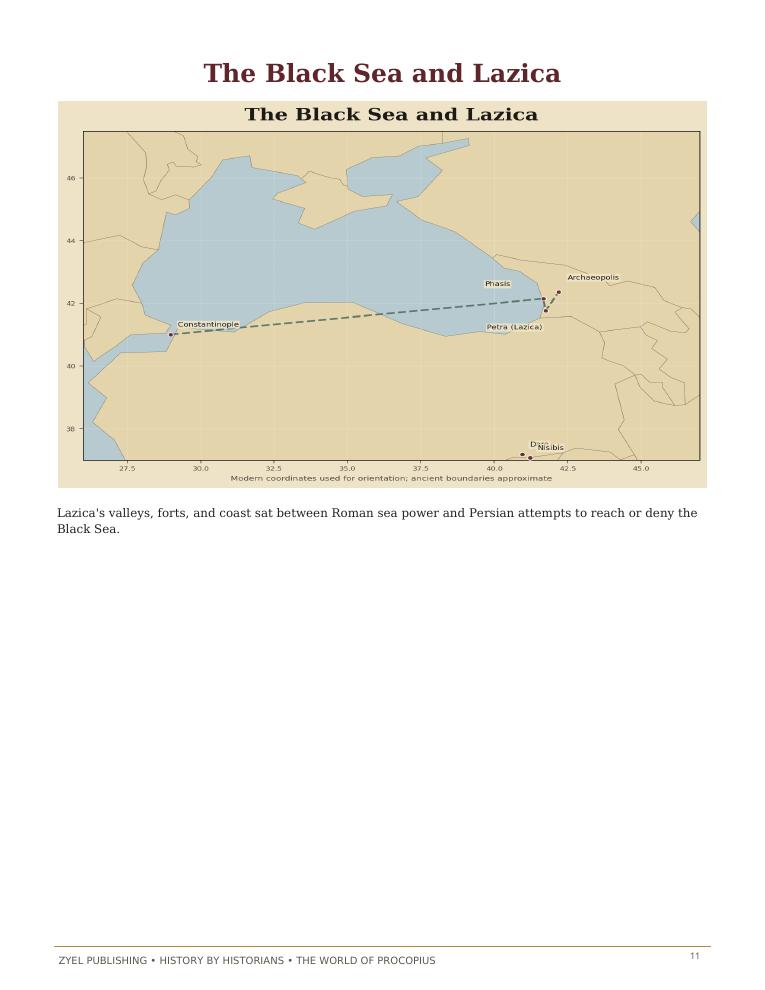
The Black Sea and Lazica

Authored historical map: The Black Sea and Lazica
Authored historical map
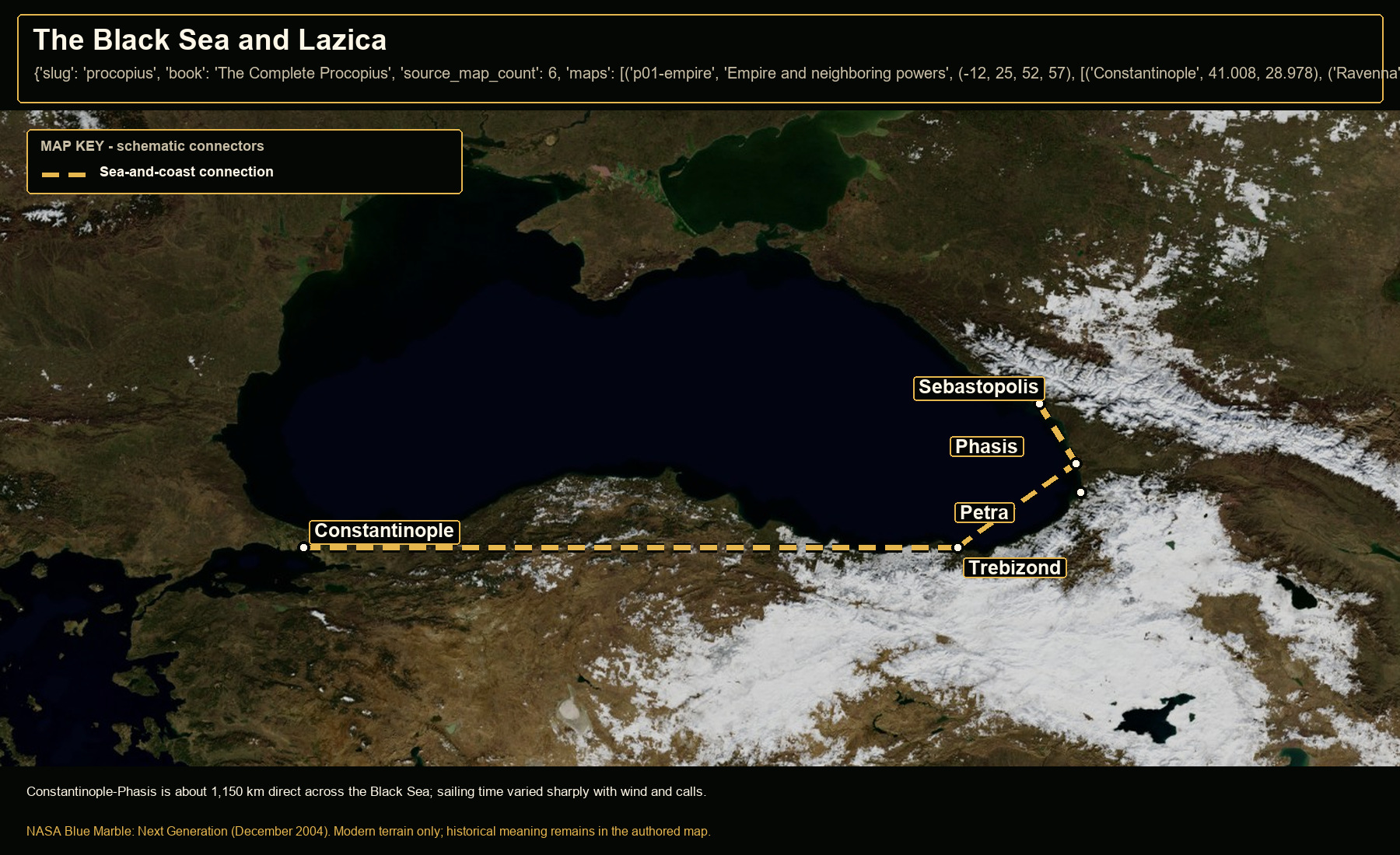
Open NASA satellite orientation map: The Black Sea and Lazica
Open satellite orientation

Constantinople-Phasis is about 1,150 km direct across the Black Sea; sailing time varied sharply with wind and calls.

Places
Constantinople · Trebizond · Phasis · Petra · Sebastopolis
Route status
Sea-and-coast connection: strategic orientation; not a fixed voyage track
Crop
24, 38, 47, 47 (west, south, east, north)

Book 02 · 9 orientation maps

Witnesses to the Breaking of Rome

9 authored map subjects, each paired with a modern terrain view.

01

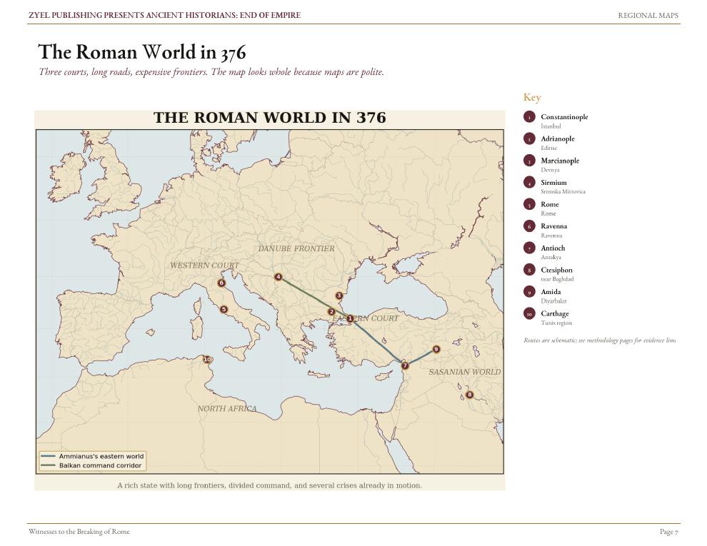
The Roman world in 376

Authored historical map: The Roman world in 376
Authored historical map
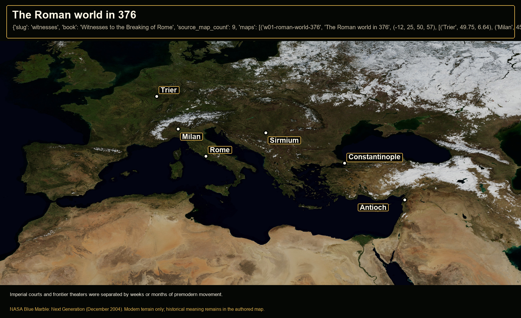
Open NASA satellite orientation map: The Roman world in 376
Open satellite orientation

Imperial courts and frontier theaters were separated by weeks or months of premodern movement.

Places
Trier · Milan · Rome · Sirmium · Constantinople · Antioch
Crop
-12, 25, 50, 57 (west, south, east, north)
02

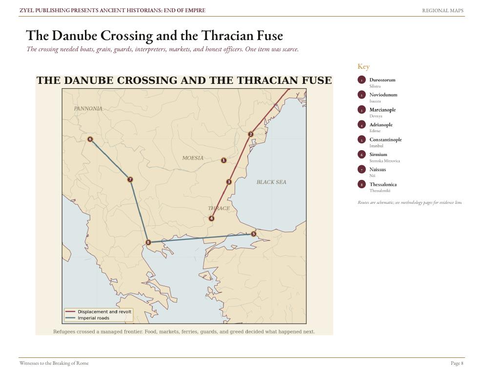
The Danube crossing and Thracian fuse

Authored historical map: The Danube crossing and Thracian fuse
Authored historical map
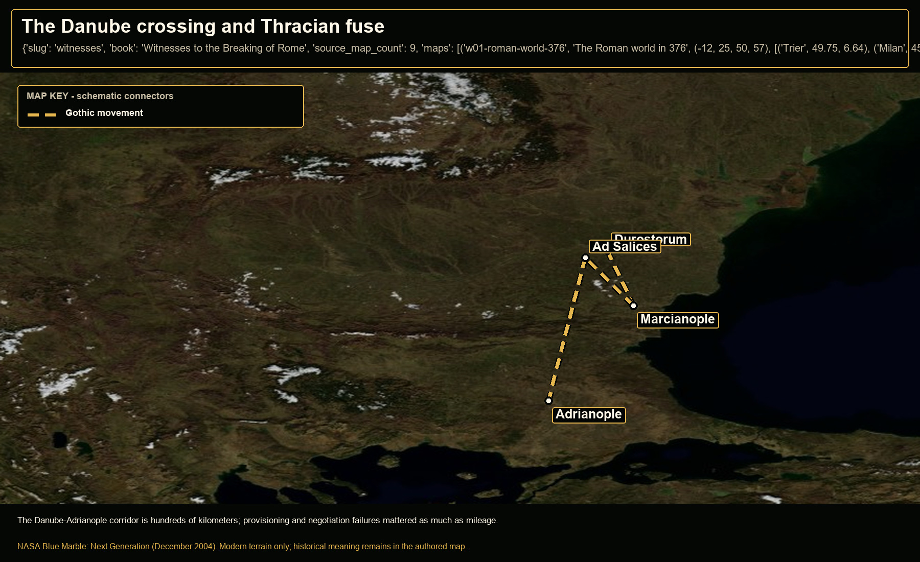
Open NASA satellite orientation map: The Danube crossing and Thracian fuse
Open satellite orientation

The Danube-Adrianople corridor is hundreds of kilometers; provisioning and negotiation failures mattered as much as mileage.

Places
Durostorum · Marcianople · Ad Salices · Adrianople
Route status
Gothic movement: reconstructed broad sequence; schematic
Crop
20, 40, 31, 47 (west, south, east, north)
03

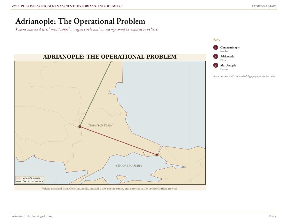
Adrianople: the operational problem

Authored historical map: Adrianople: the operational problem
Authored historical map
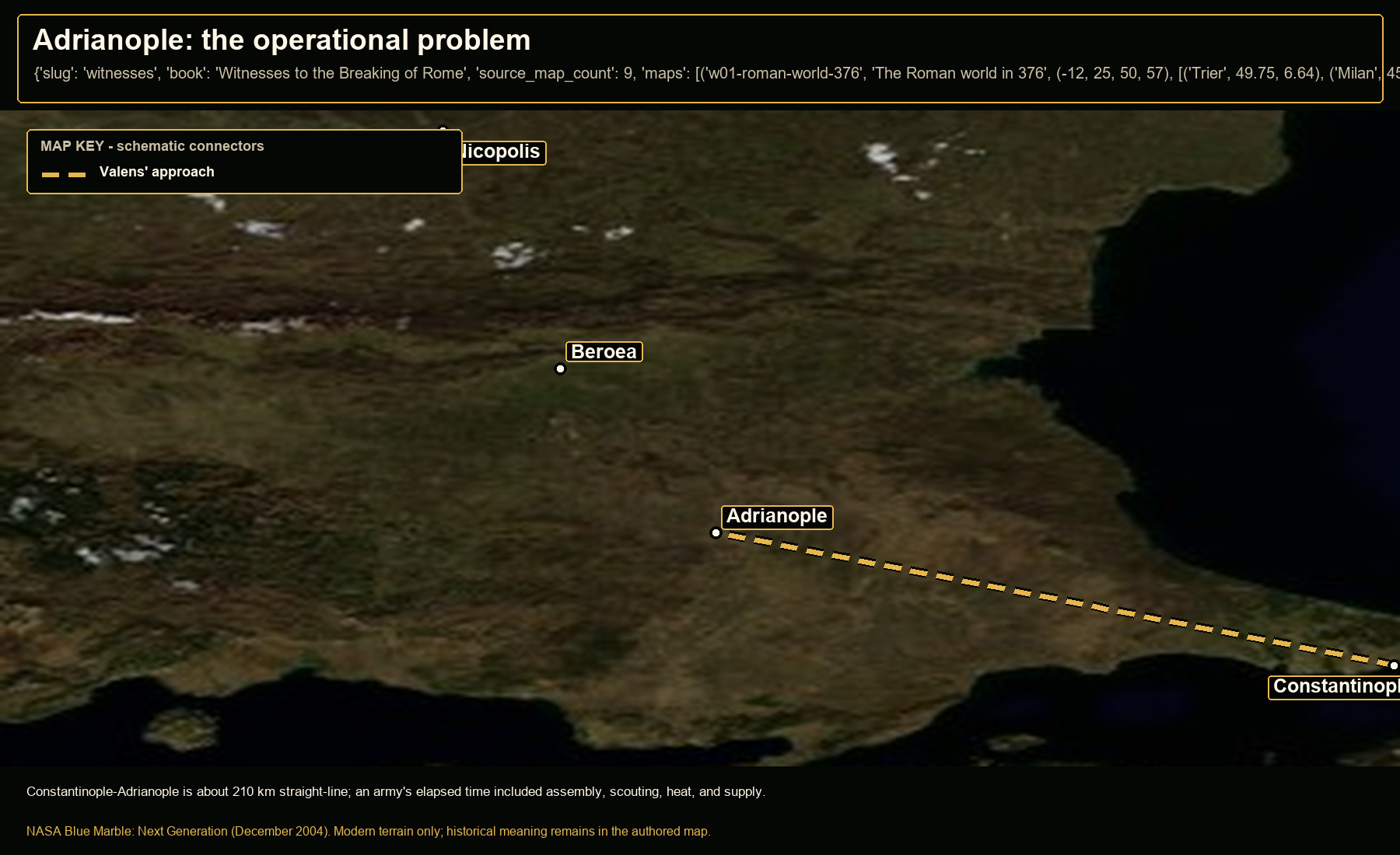
Open NASA satellite orientation map: Adrianople: the operational problem
Open satellite orientation

Constantinople-Adrianople is about 210 km straight-line; an army's elapsed time included assembly, scouting, heat, and supply.

Places
Adrianople · Constantinople · Beroea · Nicopolis
Route status
Valens' approach: approximate operational approach
Crop
24, 40.5, 29, 43.8 (west, south, east, north)
04

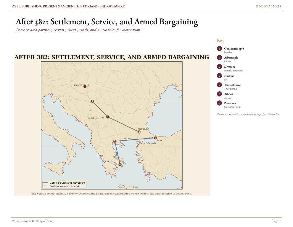
After 382: settlement and armed bargaining

Authored historical map: After 382: settlement and armed bargaining
Authored historical map
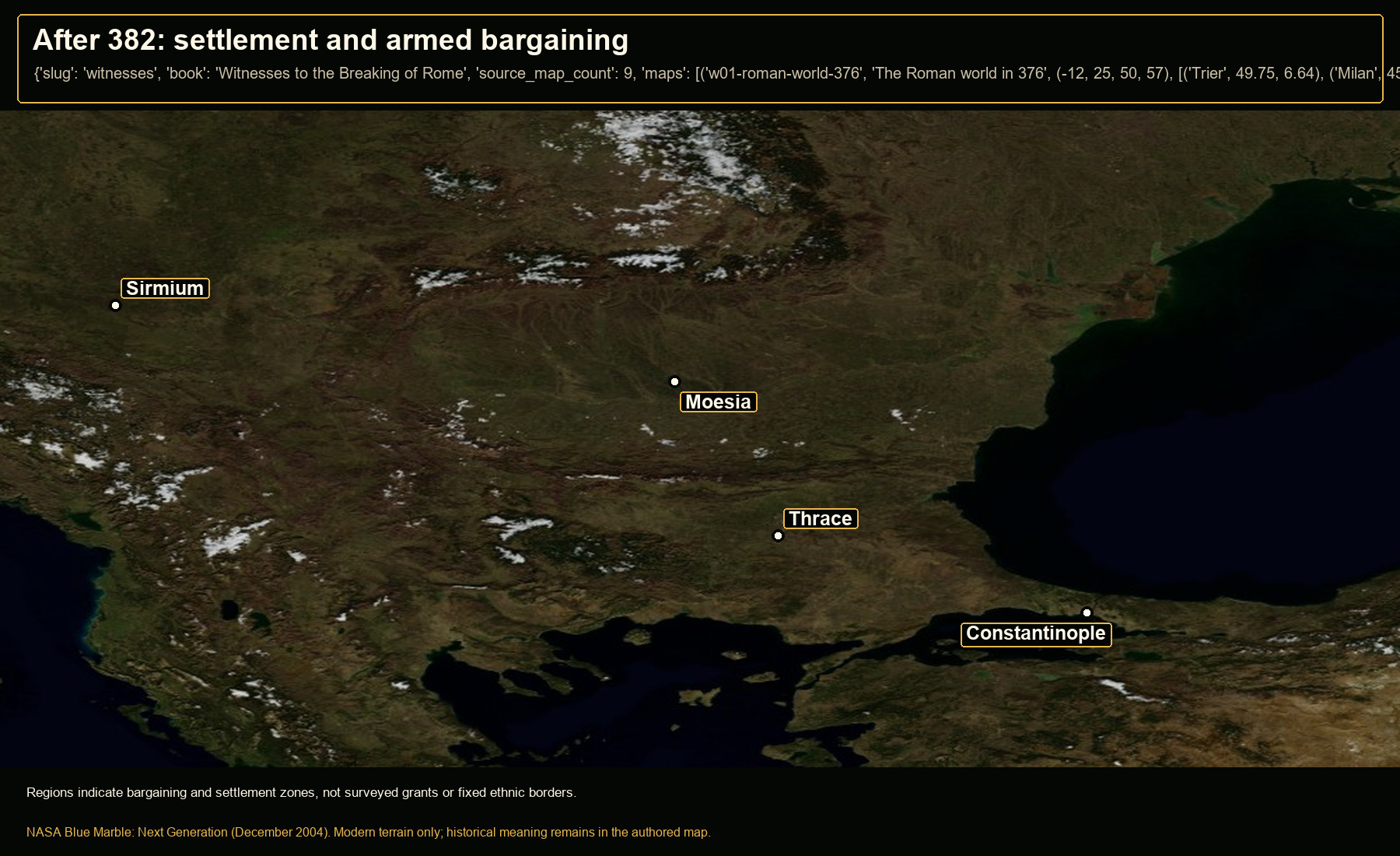
Open NASA satellite orientation map: After 382: settlement and armed bargaining
Open satellite orientation

Regions indicate bargaining and settlement zones, not surveyed grants or fixed ethnic borders.

Places
Thrace · Moesia · Sirmium · Constantinople
Crop
18.5, 39, 32, 47.5 (west, south, east, north)
05

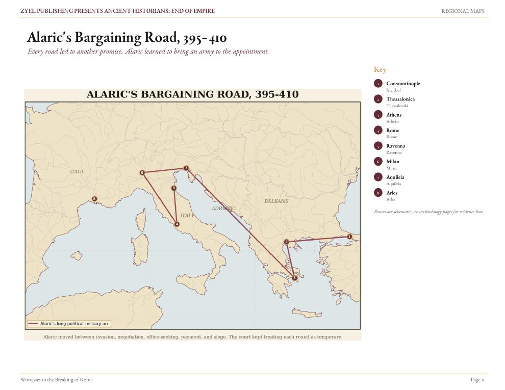
Alaric's bargaining road, 395-410

Authored historical map: Alaric's bargaining road, 395-410
Authored historical map
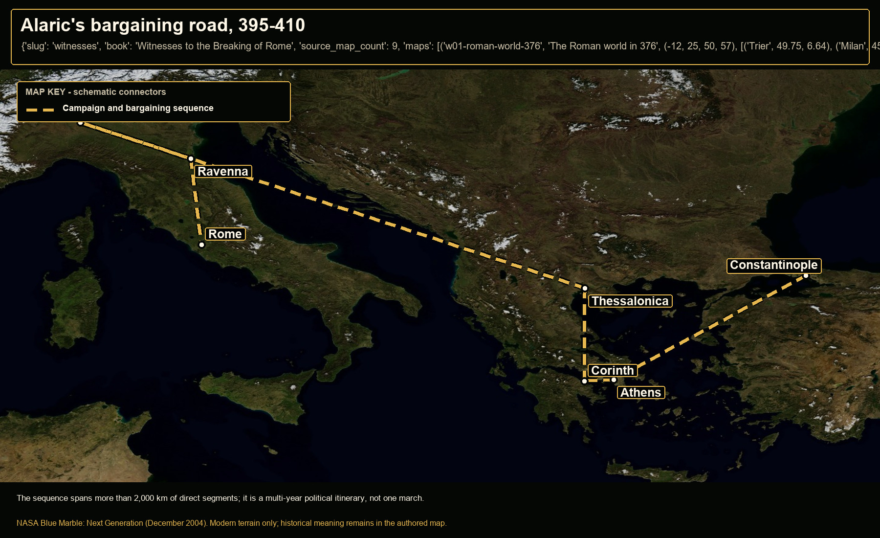
Open NASA satellite orientation map: Alaric's bargaining road, 395-410
Open satellite orientation

The sequence spans more than 2,000 km of direct segments; it is a multi-year political itinerary, not one march.
Places
Constantinople · Athens · Corinth · Thessalonica · Milan · Ravenna · Rome
Route status
Campaign and bargaining sequence: attested theaters; connectors schematic
Crop
7, 35, 31, 47 (west, south, east, north)
06

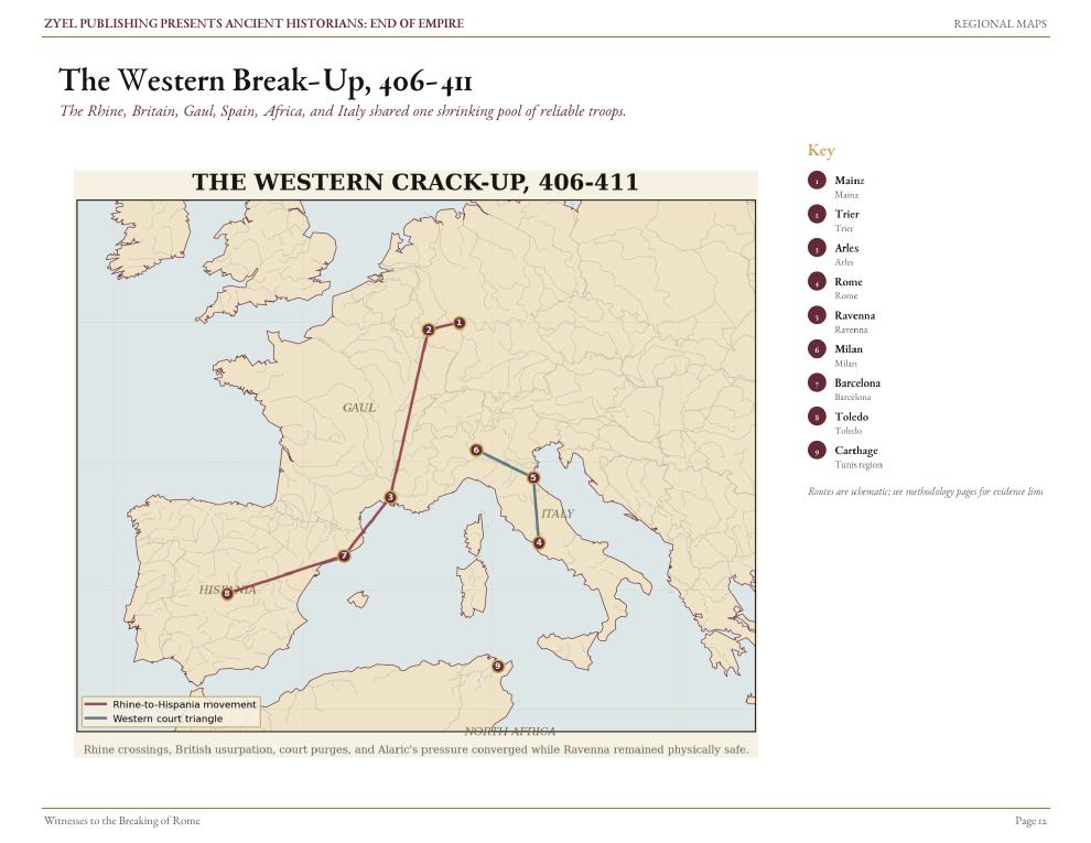
The Western break-up, 406-411

Authored historical map: The Western break-up, 406-411
Authored historical map
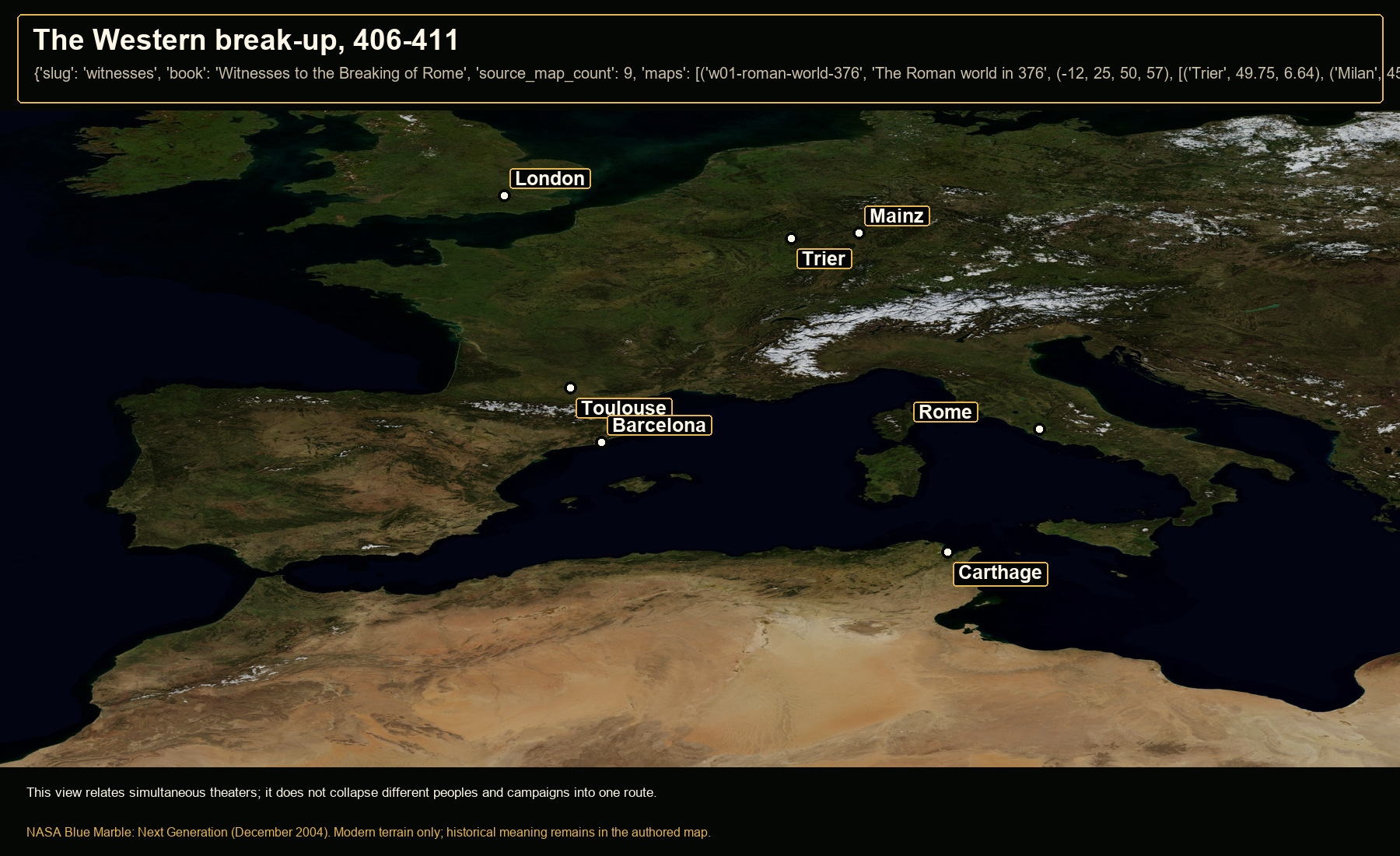
Open NASA satellite orientation map: The Western break-up, 406-411
Open satellite orientation

This view relates simultaneous theaters; it does not collapse different peoples and campaigns into one route.
Places
Mainz · Trier · London · Toulouse · Barcelona · Carthage · Rome
Crop
-12, 28, 21, 55 (west, south, east, north)
07

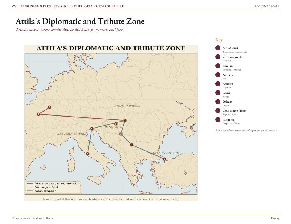
Attila's diplomatic and tribute zone

Authored historical map: Attila's diplomatic and tribute zone
Authored historical map
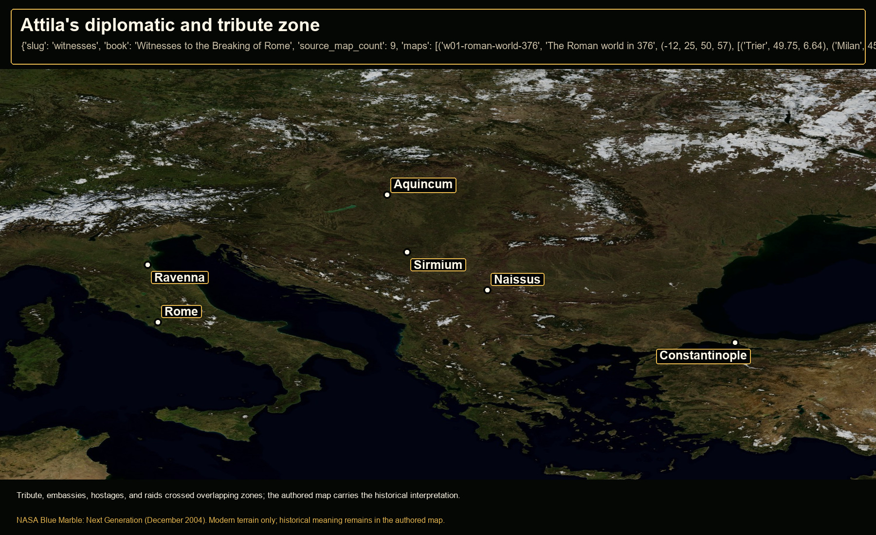
Open NASA satellite orientation map: Attila's diplomatic and tribute zone
Open satellite orientation

Tribute, embassies, hostages, and raids crossed overlapping zones; the authored map carries the historical interpretation.

Places
Aquincum · Sirmium · Naissus · Constantinople · Rome · Ravenna
Crop
8, 35, 33, 53 (west, south, east, north)
08

Theoderic's road to Italy

Authored historical map: Theoderic's road to Italy
Authored historical map
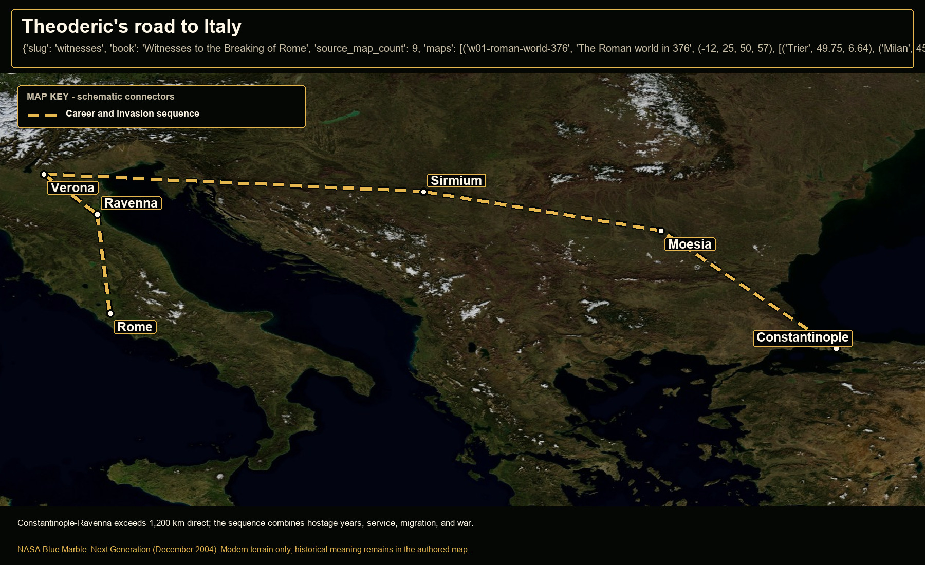
Open NASA satellite orientation map: Theoderic's road to Italy
Open satellite orientation

Constantinople-Ravenna exceeds 1,200 km direct; the sequence combines hostage years, service, migration, and war.

Places
Constantinople · Moesia · Sirmium · Verona · Ravenna · Rome
Route status
Career and invasion sequence: broad attested sequence; schematic
Crop
10, 37, 31, 48 (west, south, east, north)
09

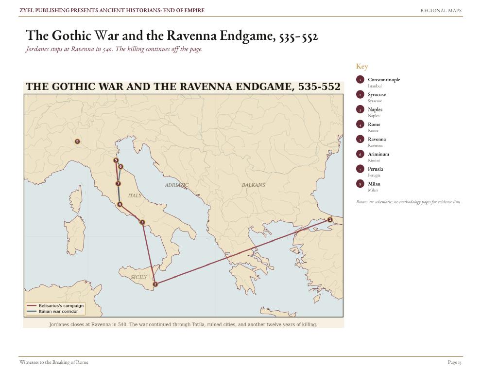
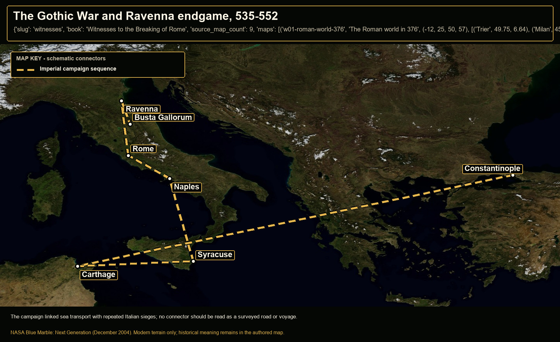
The Gothic War and Ravenna endgame, 535-552

Authored historical map: The Gothic War and Ravenna endgame, 535-552
Authored historical map
Open NASA satellite orientation map: The Gothic War and Ravenna endgame, 535-552
Open satellite orientation

The campaign linked sea transport with repeated Italian sieges; no connector should be read as a surveyed road or voyage.

Places
Constantinople · Carthage · Syracuse · Naples · Rome · Ravenna · Busta Gallorum
Route status
Imperial campaign sequence: attested theaters; schematic connectors
Crop
7, 35, 31, 47 (west, south, east, north)

Book 03 · 4 orientation maps

Richard and Saladin

4 authored map subjects, each paired with a modern terrain view.

01

Richard's routes to Messina, 1189-1190

Open NASA satellite orientation map: Richard's routes to Messina, 1189-1190
replacement open satellite map and orientation companion

Observed chronology: fleet assembly and the staged voyage occupied months before the 23 September 1190 arrival at Messina; this is elapsed campaign time, not a sailing-speed estimate.

Places
Dartmouth · Lisbon · Gibraltar · Messina · Barcelona · Chinon · Vezelay · Lyon · Marseille · Genoa · Pisa · Naples
Route status
English fleet: attested waypoints; schematic connectors · Richard's royal itinerary: attested itinerary; schematic connectors
Crop
-11, 34, 18.5, 52 (west, south, east, north)
02

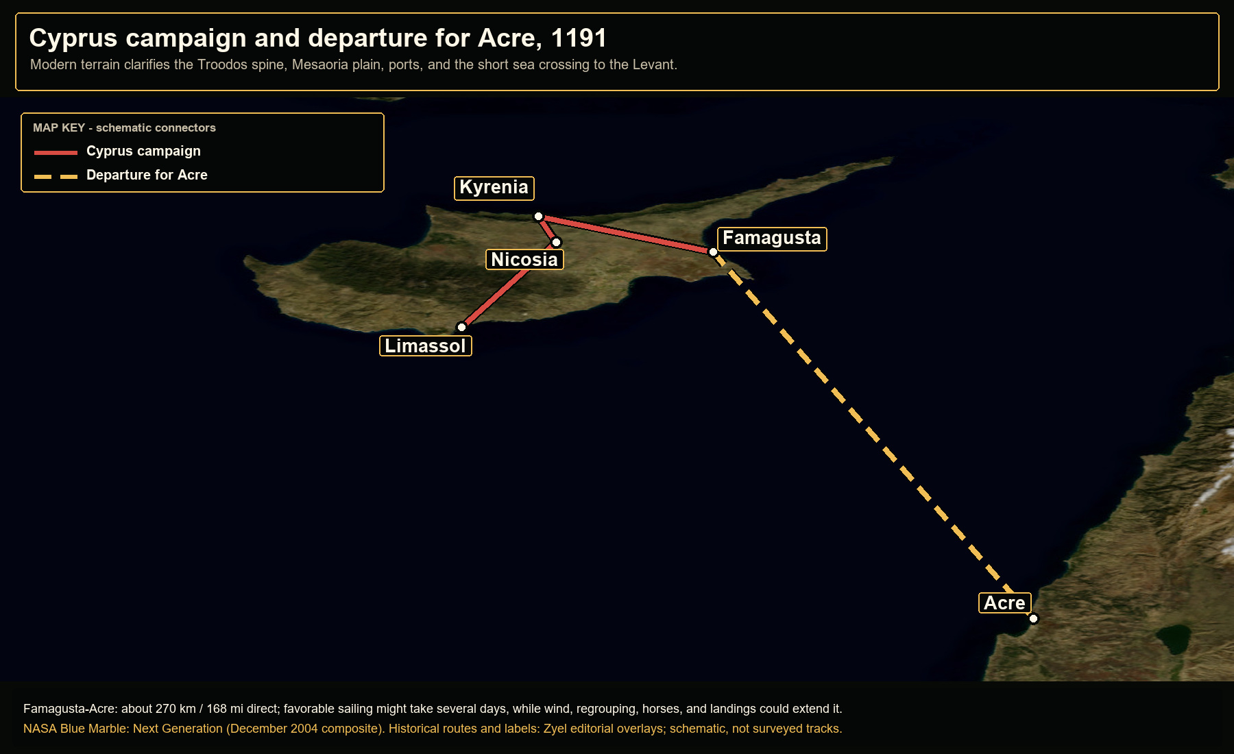
Cyprus campaign and departure for Acre, 1191

Open NASA satellite orientation map: Cyprus campaign and departure for Acre, 1191
replacement open satellite map and orientation companion

Modeled orientation: about 2-5 favorable sailing days for the open-water distance, with convoying, horse transport, weather, and coastal calls capable of extending the passage.

Places
Limassol · Nicosia · Famagusta · Kyrenia · Acre
Route status
Cyprus campaign: schematic campaign sequence · Departure for Acre: attested departure and destination; schematic sea track
Crop
31.4, 32.55, 35.8, 36.05 (west, south, east, north)
03

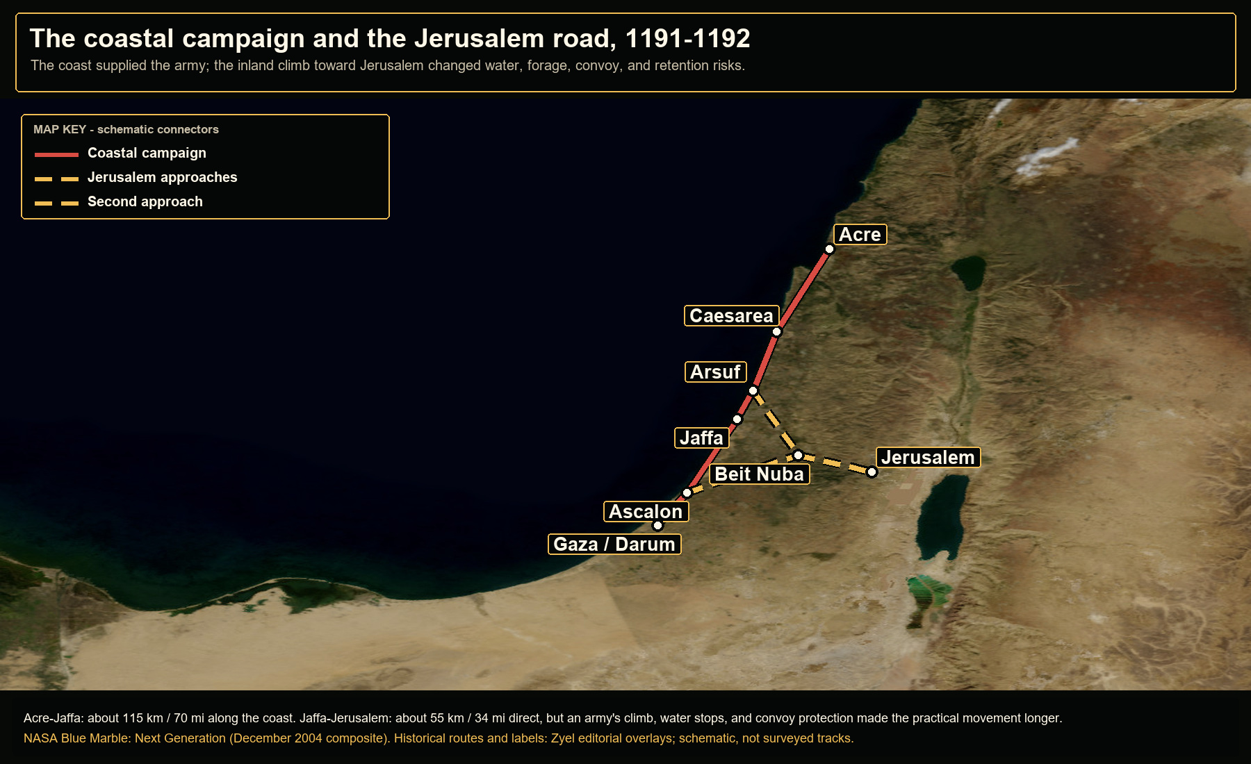
The coastal campaign and the Jerusalem road, 1191-1192

Open NASA satellite orientation map: The coastal campaign and the Jerusalem road, 1191-1192
replacement open satellite map and orientation companion

Observed chronology: the campaign left Acre on 22 August 1191, fought at Arsuf on 7 September, and continued to Jaffa; the elapsed time includes formation, scouting, supply, and combat rather than pure marching.

Places
Acre · Caesarea · Arsuf · Jaffa · Ascalon · Gaza / Darum · Beit Nuba · Jerusalem
Route status
Coastal campaign: attested sequence; schematic connectors · Jerusalem approaches: approximate operational approaches · Second approach: approximate operational approach
Crop
32.1, 30.65, 36.6, 33.7 (west, south, east, north)
04

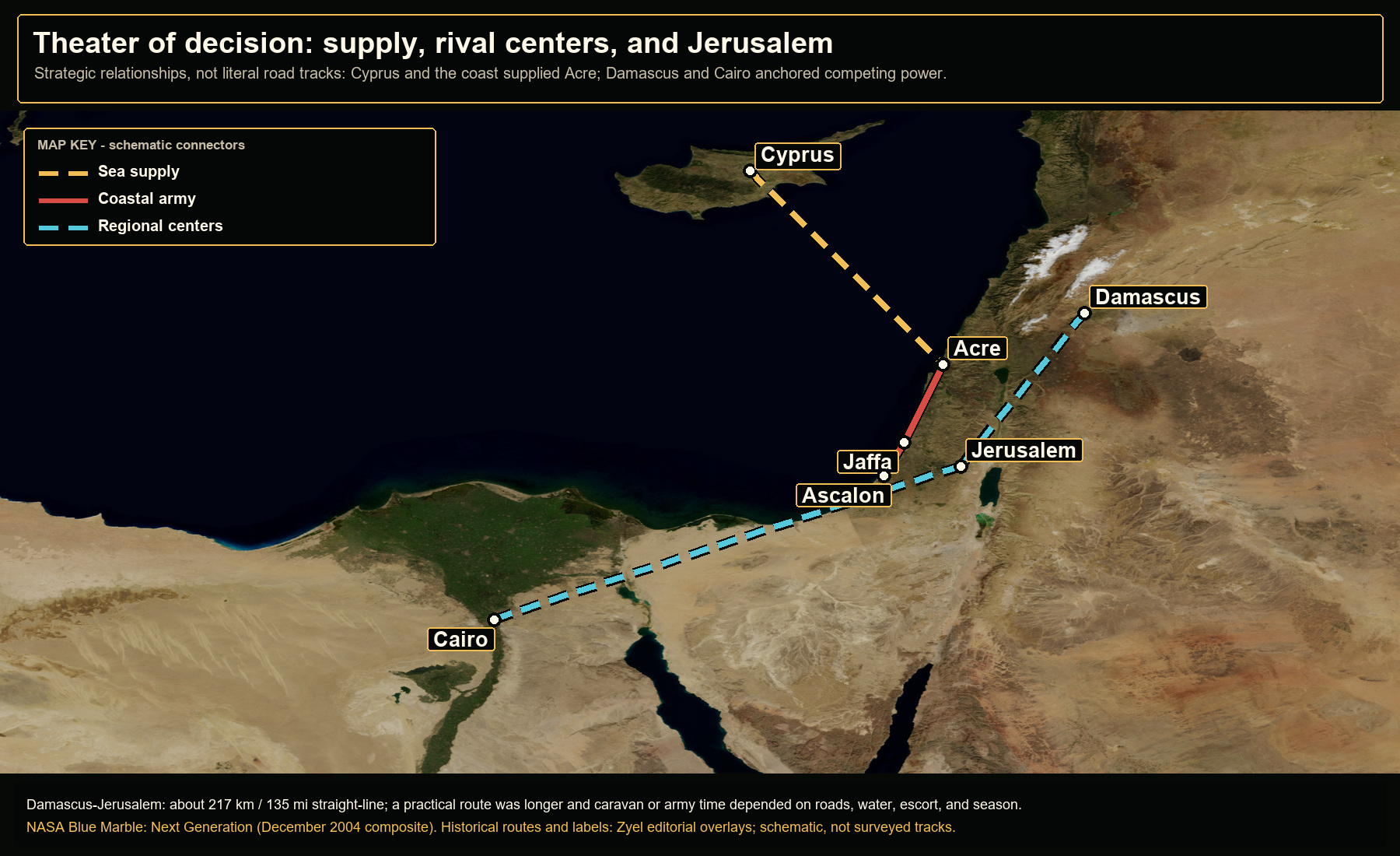
Theater of decision: supply, rival centers, and Jerusalem

Open NASA satellite orientation map: Theater of decision: supply, rival centers, and Jerusalem
replacement open satellite map and orientation companion

Modeled orientation: 217 km alone represents about 7-14 days at 16-32 km per day before road detours, water, security, and seasonal constraints; this line is strategic, not an attested march.

Places
Cyprus · Acre · Jaffa · Ascalon · Jerusalem · Damascus · Cairo
Route status
Sea supply: strategic relationship; not a fixed route · Coastal army: attested campaign corridor; schematic connectors · Regional centers: strategic relationship; not a road track
Crop
27, 28.3, 39, 35.8 (west, south, east, north)

Book 04 · 8 orientation maps

Mountains of Silver, Oceans of Debt

8 authored map subjects, each paired with a modern terrain view.

01

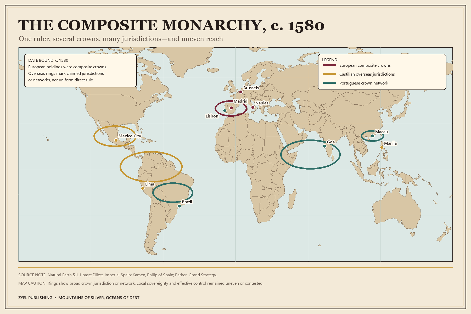
The composite monarchy, c. 1580

Authored historical map: The composite monarchy, c. 1580
Authored historical map
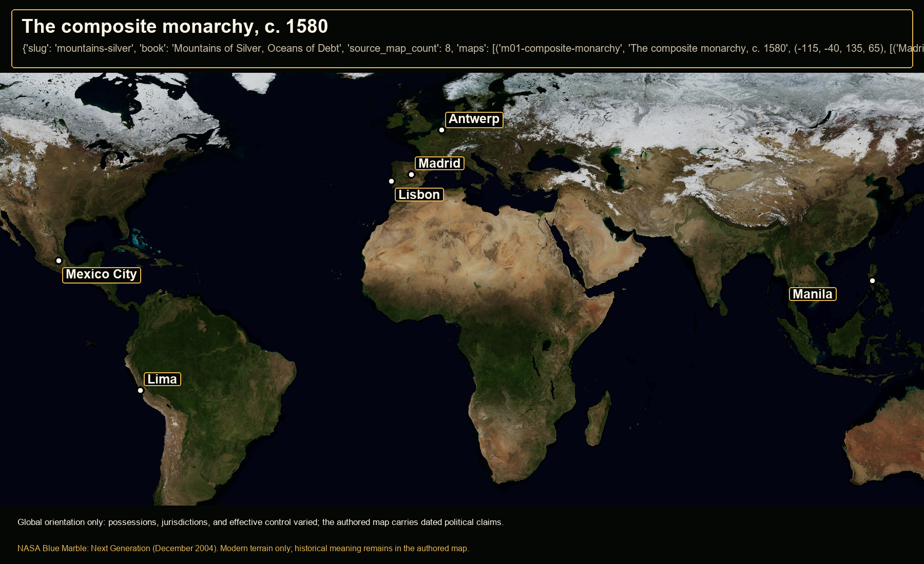
Open NASA satellite orientation map: The composite monarchy, c. 1580
Open satellite orientation

Global orientation only: possessions, jurisdictions, and effective control varied; the authored map carries dated political claims.

Places
Madrid · Lisbon · Antwerp · Mexico City · Lima · Manila
Crop
-115, -40, 135, 65 (west, south, east, north)
02

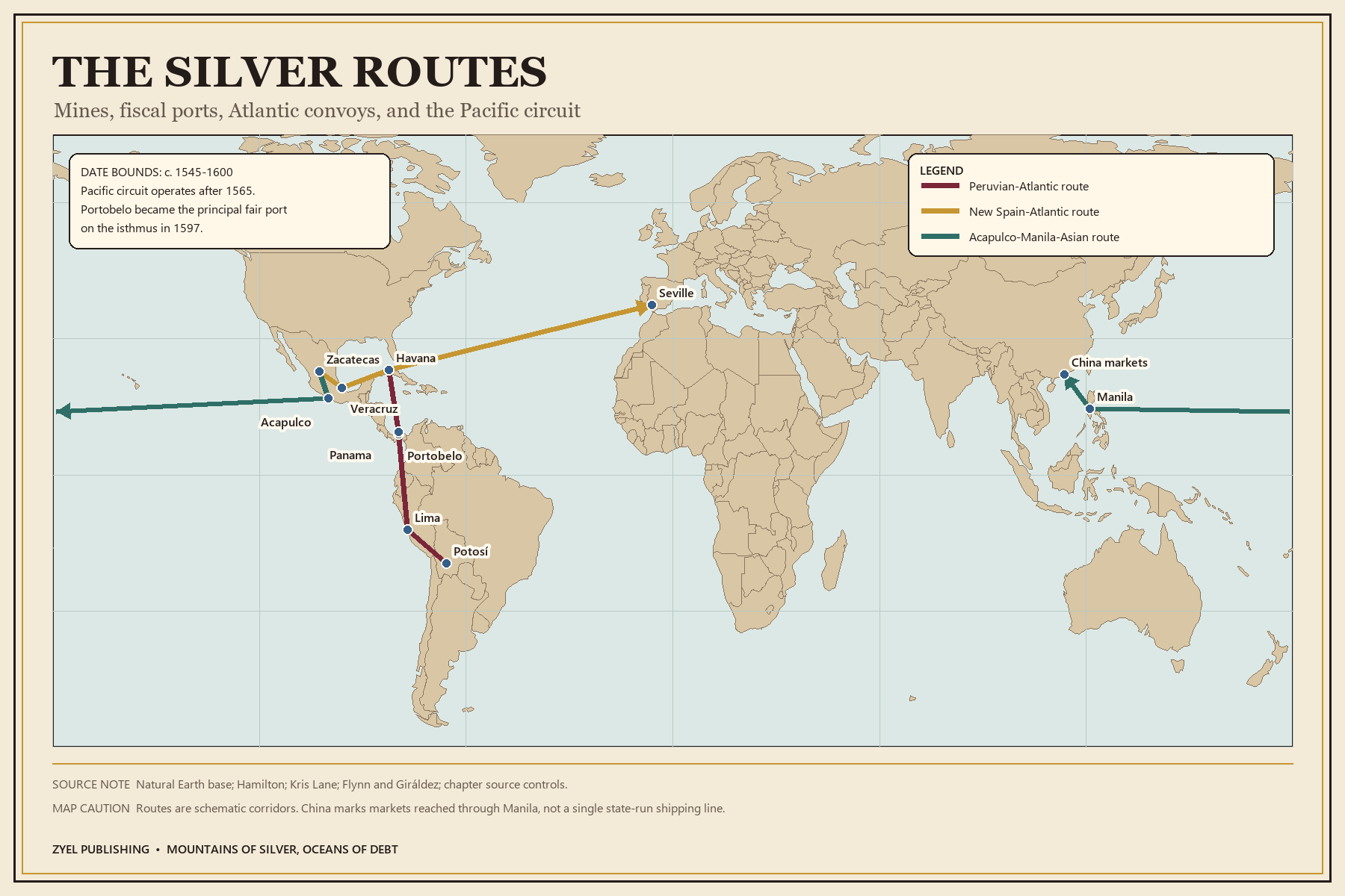
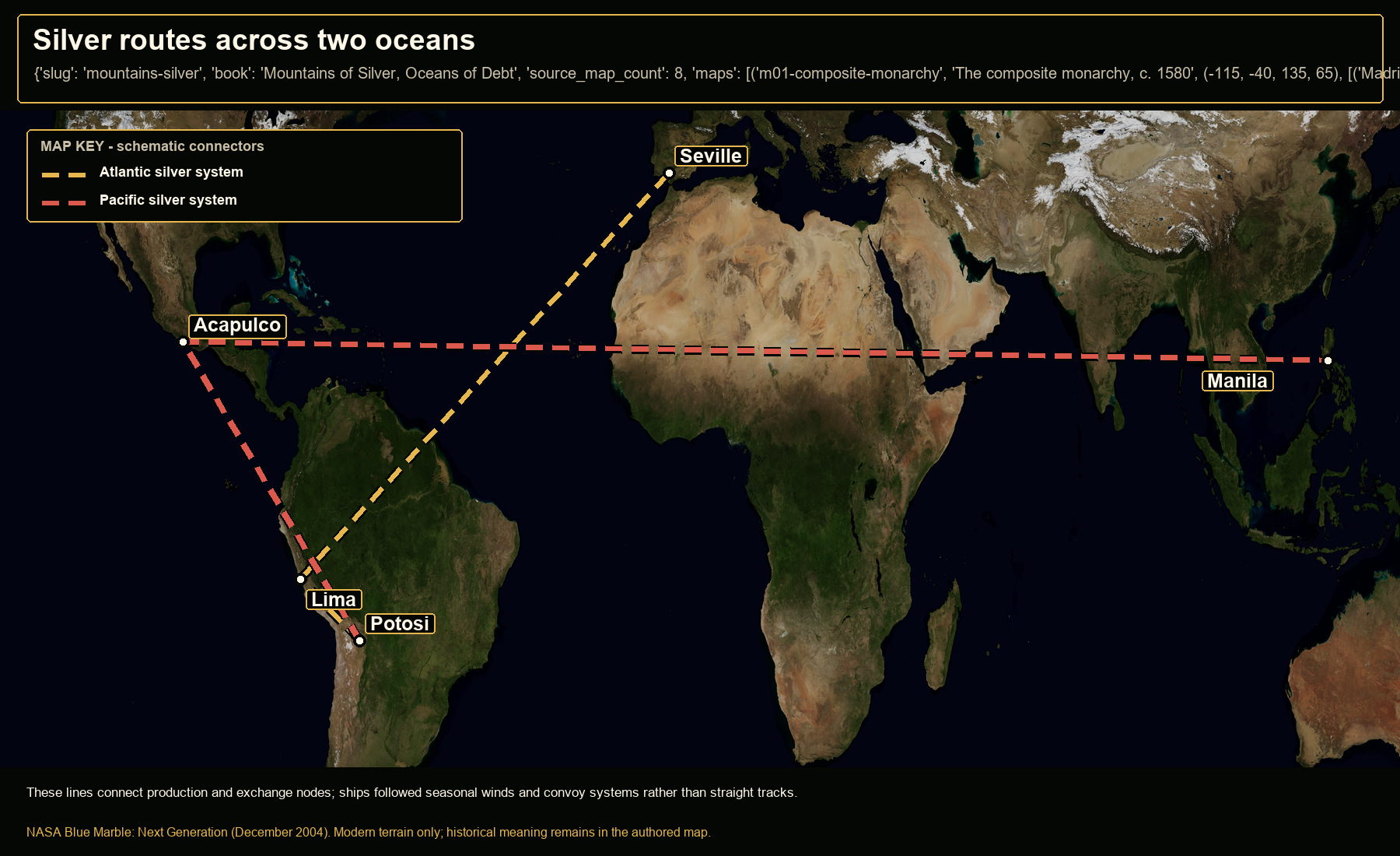
Silver routes across two oceans

Authored historical map: Silver routes across two oceans
Authored historical map
Open NASA satellite orientation map: Silver routes across two oceans
Open satellite orientation

These lines connect production and exchange nodes; ships followed seasonal winds and convoy systems rather than straight tracks.

Places
Potosi · Lima · Acapulco · Manila · Seville
Route status
Atlantic silver system: schematic oceanic connection · Pacific silver system: schematic trans-Pacific connection
Crop
-135, -35, 135, 45 (west, south, east, north)
03

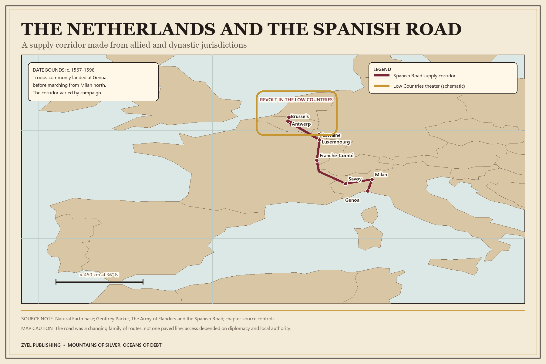
The Low Countries and the Spanish Road

Authored historical map: The Low Countries and the Spanish Road
Authored historical map
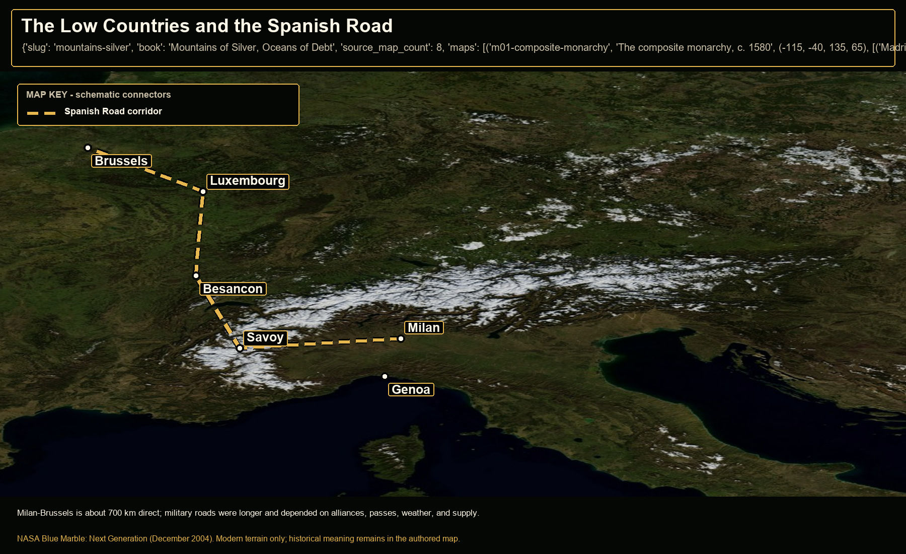
Open NASA satellite orientation map: The Low Countries and the Spanish Road
Open satellite orientation

Milan-Brussels is about 700 km direct; military roads were longer and depended on alliances, passes, weather, and supply.

Places
Milan · Genoa · Savoy · Besancon · Luxembourg · Brussels
Route status
Spanish Road corridor: schematic strategic corridor; routes varied
Crop
3, 41, 17, 53 (west, south, east, north)
04

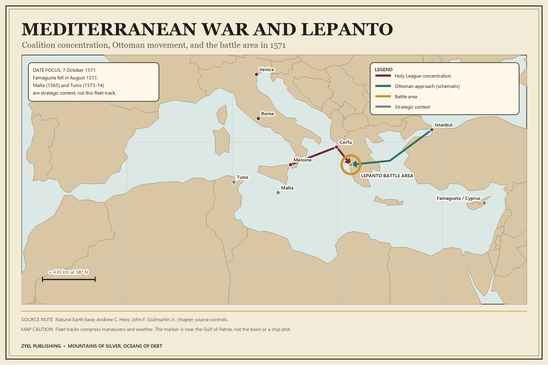
The Lepanto theater, 1571

Authored historical map: The Lepanto theater, 1571
Authored historical map
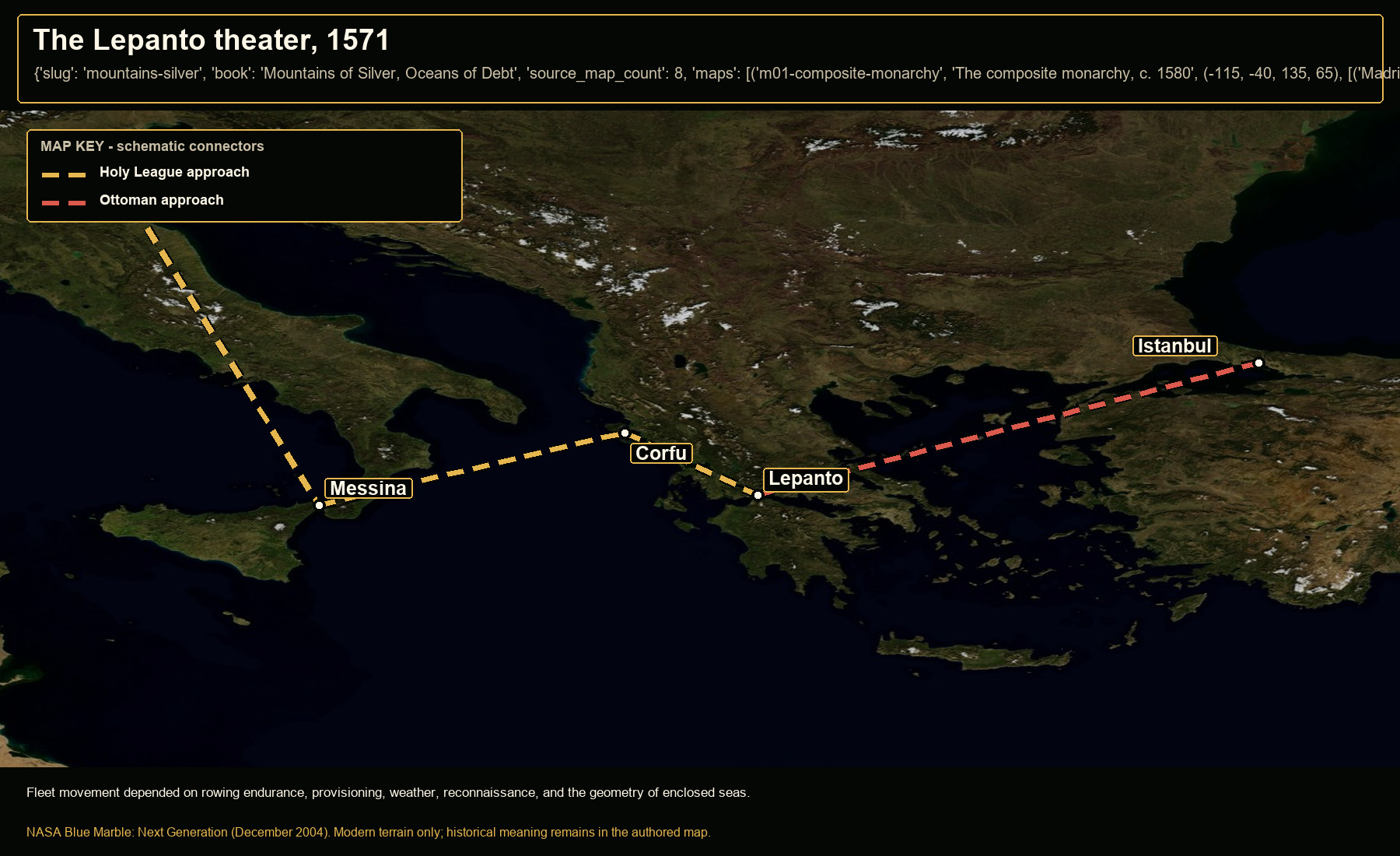
Open NASA satellite orientation map: The Lepanto theater, 1571
Open satellite orientation

Fleet movement depended on rowing endurance, provisioning, weather, reconnaissance, and the geometry of enclosed seas.

Places
Messina · Corfu · Lepanto · Venice · Istanbul
Route status
Holy League approach: schematic fleet sequence · Ottoman approach: schematic strategic connection
Crop
11, 33, 31, 46 (west, south, east, north)
05

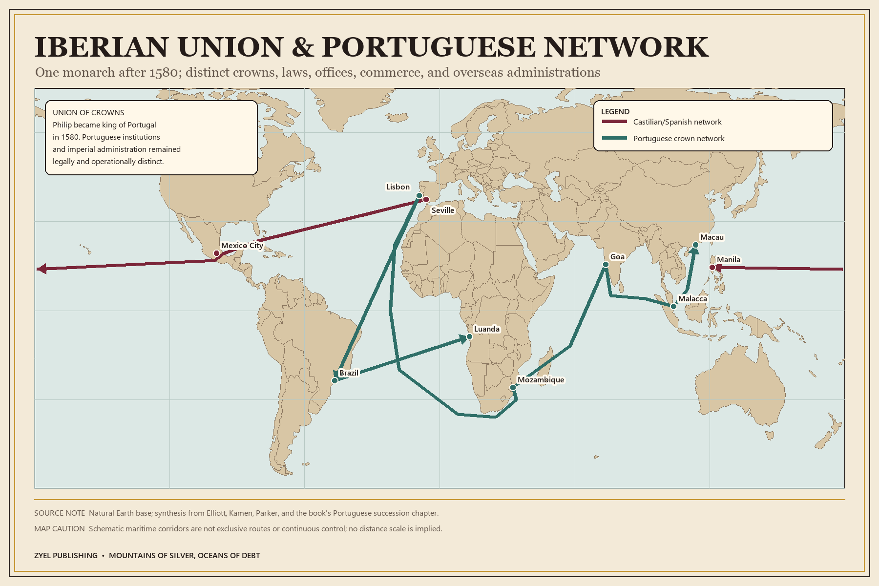
The Iberian Union's global reach

Authored historical map: The Iberian Union's global reach
Authored historical map
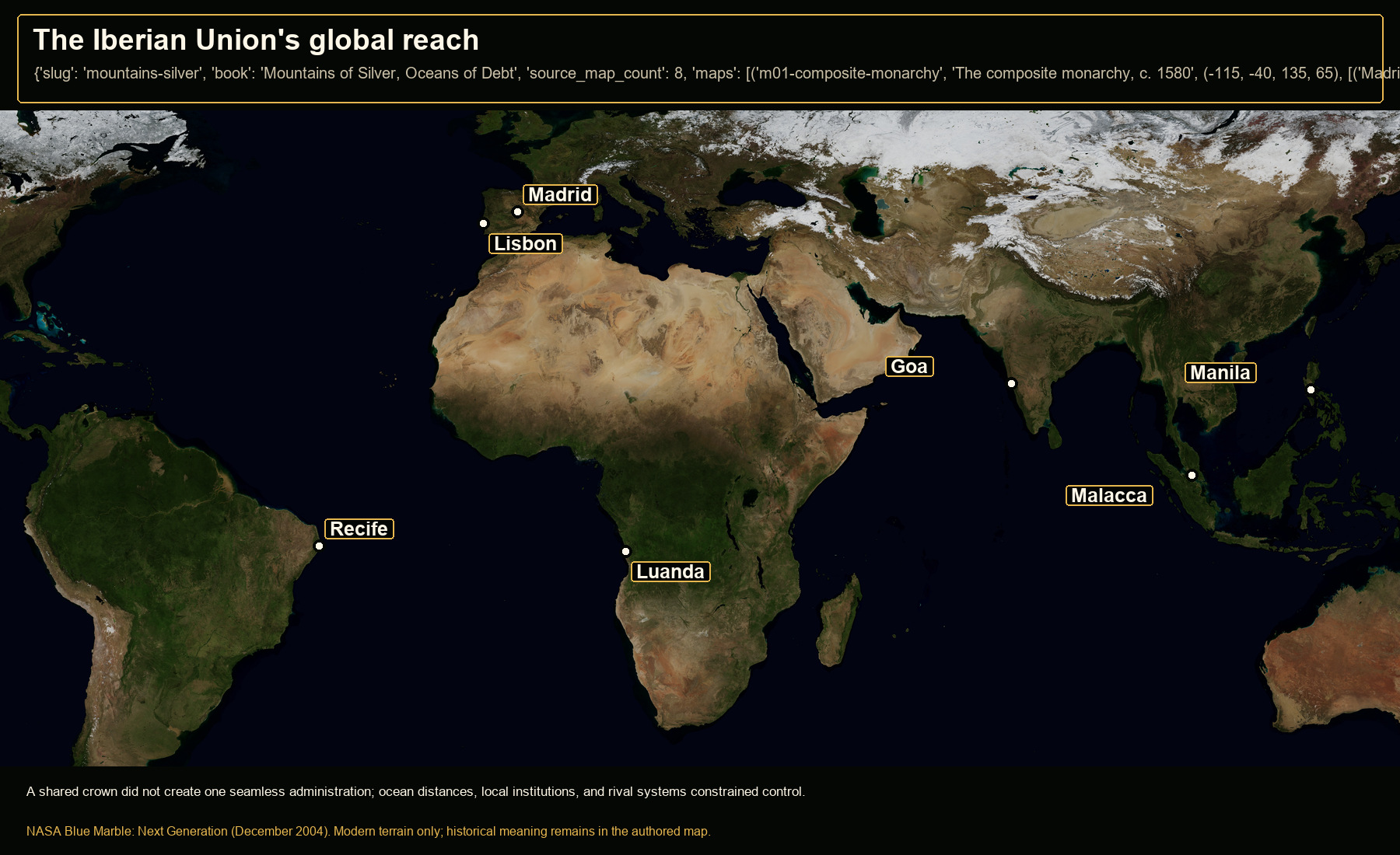
Open NASA satellite orientation map: The Iberian Union's global reach
Open satellite orientation

A shared crown did not create one seamless administration; ocean distances, local institutions, and rival systems constrained control.

Places
Madrid · Lisbon · Recife · Luanda · Goa · Malacca · Manila
Crop
-85, -40, 135, 55 (west, south, east, north)
06

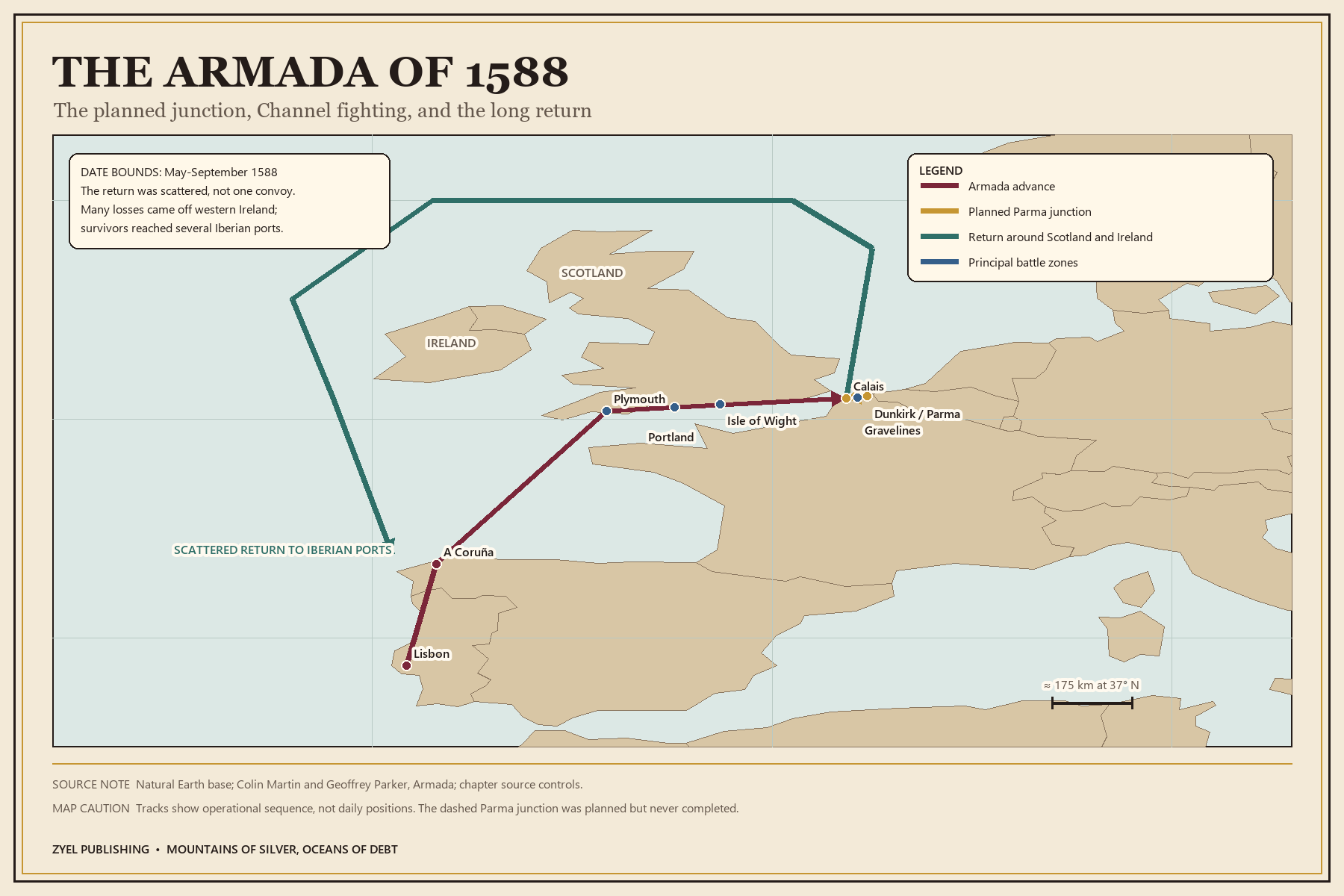
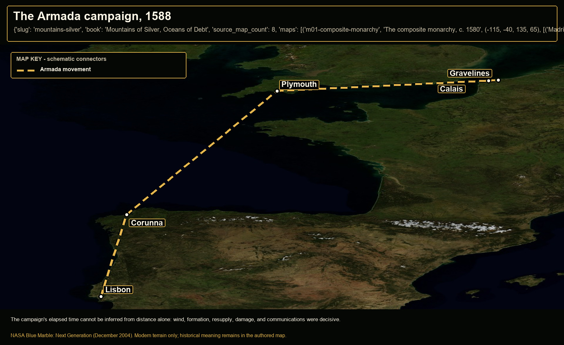
The Armada campaign, 1588

Authored historical map: The Armada campaign, 1588
Authored historical map
Open NASA satellite orientation map: The Armada campaign, 1588
Open satellite orientation

The campaign's elapsed time cannot be inferred from distance alone: wind, formation, resupply, damage, and communications were decisive.

Places
Lisbon · Corunna · Plymouth · Calais · Gravelines
Route status
Armada movement: attested broad sequence; schematic sea track
Crop
-12, 38, 4, 53 (west, south, east, north)
07

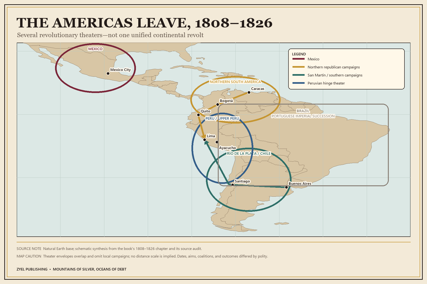
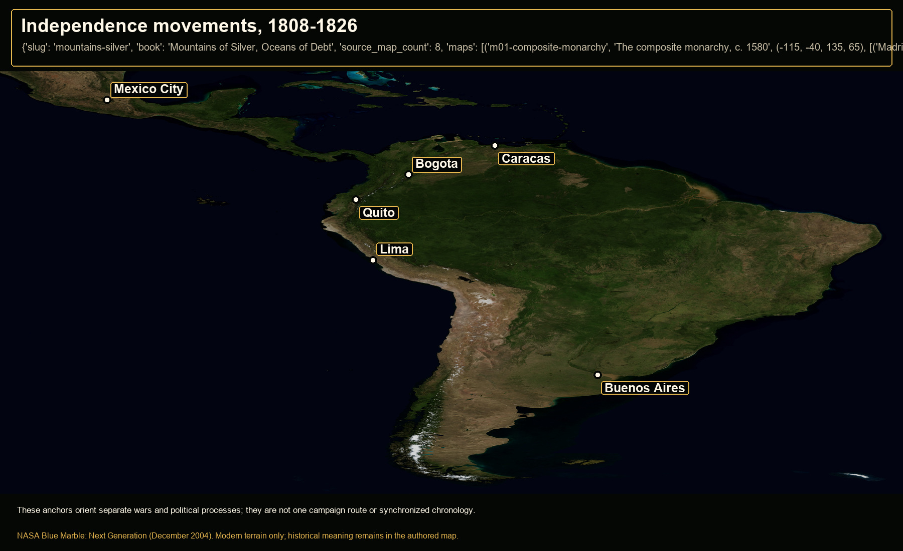
Independence movements, 1808-1826

Authored historical map: Independence movements, 1808-1826
Authored historical map
Open NASA satellite orientation map: Independence movements, 1808-1826
Open satellite orientation

These anchors orient separate wars and political processes; they are not one campaign route or synchronized chronology.

Places
Mexico City · Caracas · Bogota · Quito · Lima · Buenos Aires
Crop
-108, -58, -33, 25 (west, south, east, north)
08

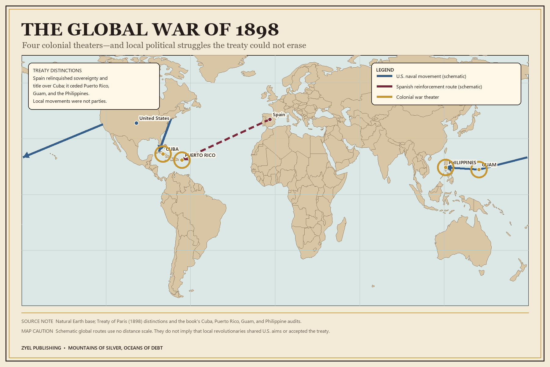
The global war of 1898

Authored historical map: The global war of 1898
Authored historical map
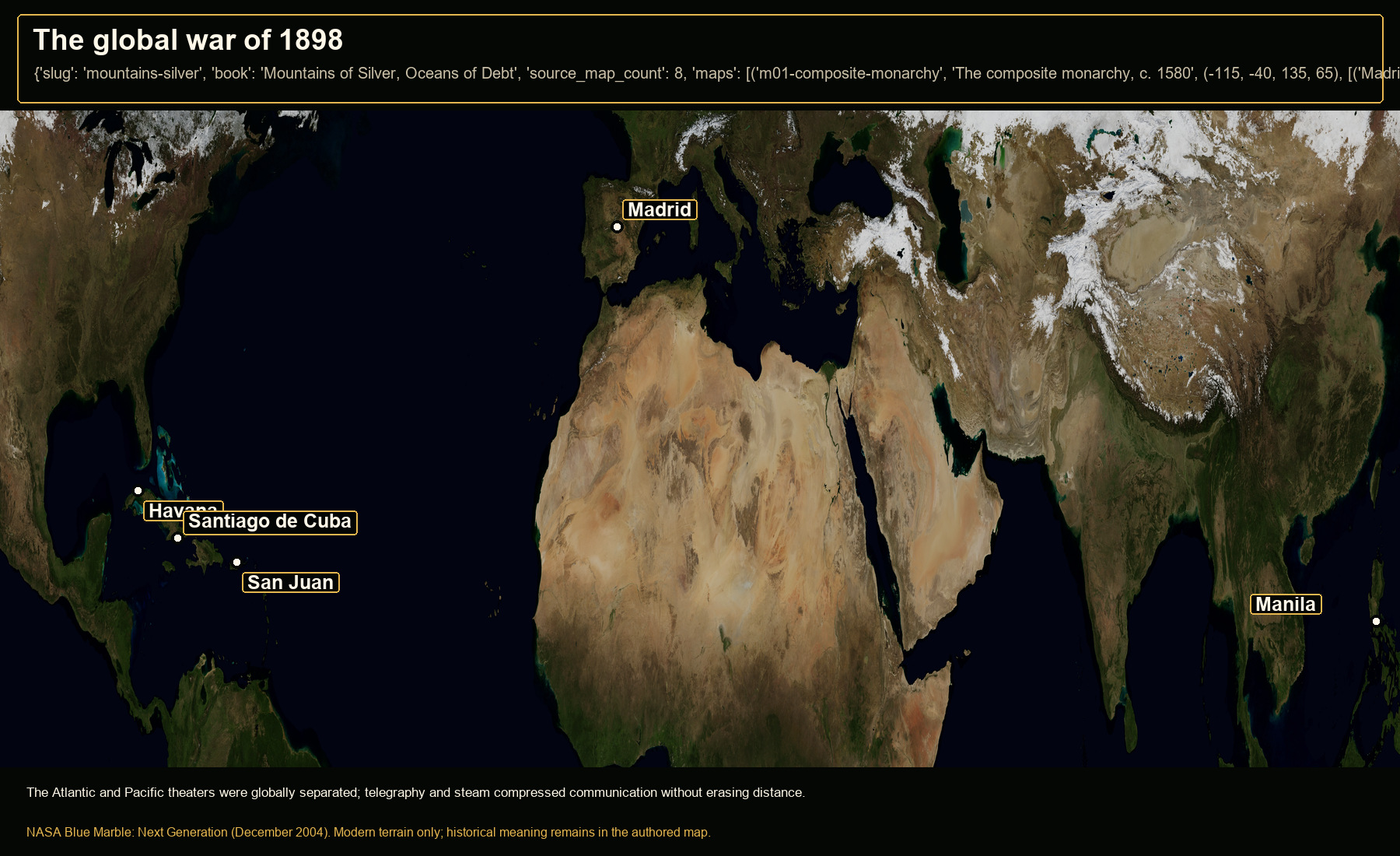
Open NASA satellite orientation map: The global war of 1898
Open satellite orientation

The Atlantic and Pacific theaters were globally separated; telegraphy and steam compressed communication without erasing distance.

Places
Madrid · Havana · Santiago de Cuba · San Juan · Manila
Crop
-105, 5, 125, 48 (west, south, east, north)

Book 05 · 6 orientation maps

The Emperor at War with Heaven

New geographic coverage for a book that previously had no maps.

01

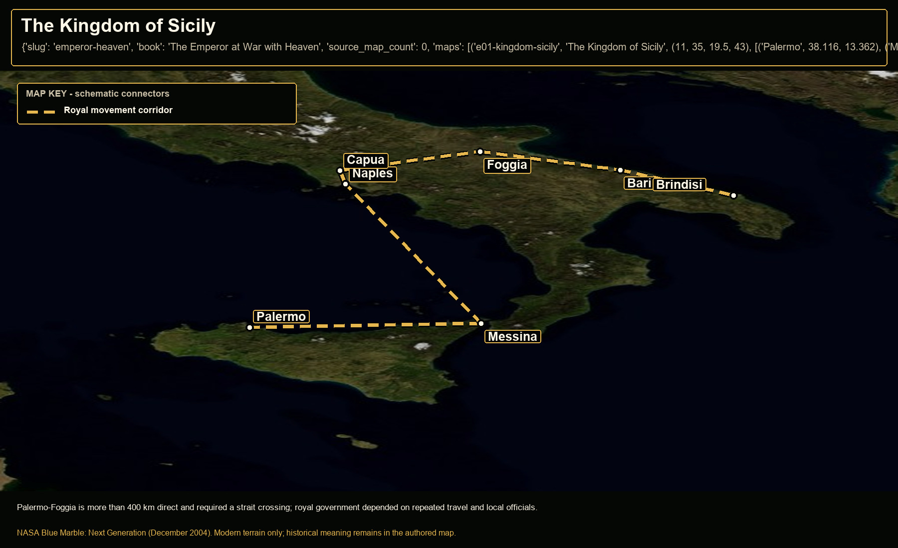
The Kingdom of Sicily

Open NASA satellite orientation map: The Kingdom of Sicily
new geographic coverage for an unmapped book

Palermo-Foggia is more than 400 km direct and required a strait crossing; royal government depended on repeated travel and local officials.

Places
Palermo · Messina · Naples · Foggia · Capua · Bari · Brindisi
Route status
Royal movement corridor: representative itinerary; not one continuous journey
Crop
11, 35, 19.5, 43 (west, south, east, north)
02

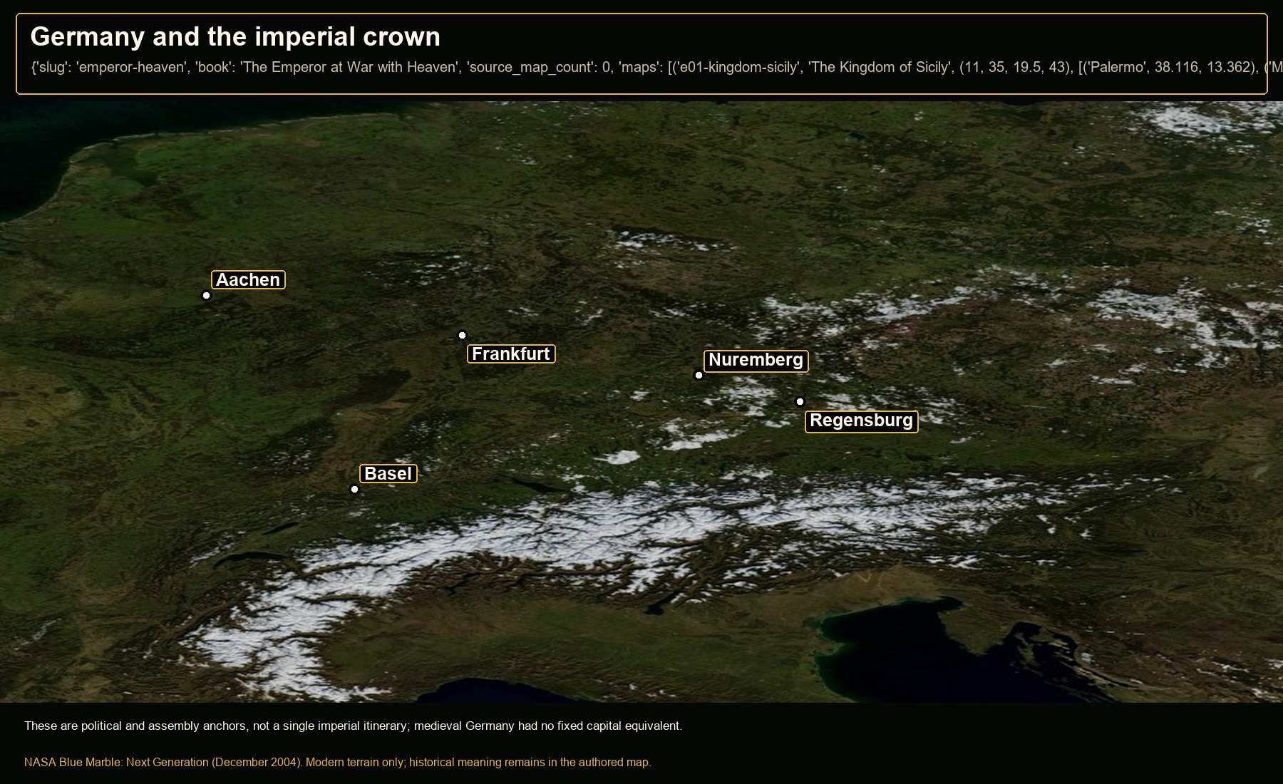
Germany and the imperial crown

Open NASA satellite orientation map: Germany and the imperial crown
new geographic coverage for an unmapped book

These are political and assembly anchors, not a single imperial itinerary; medieval Germany had no fixed capital equivalent.

Places
Aachen · Frankfurt · Nuremberg · Regensburg · Basel
Crop
4, 44, 17, 54 (west, south, east, north)
03

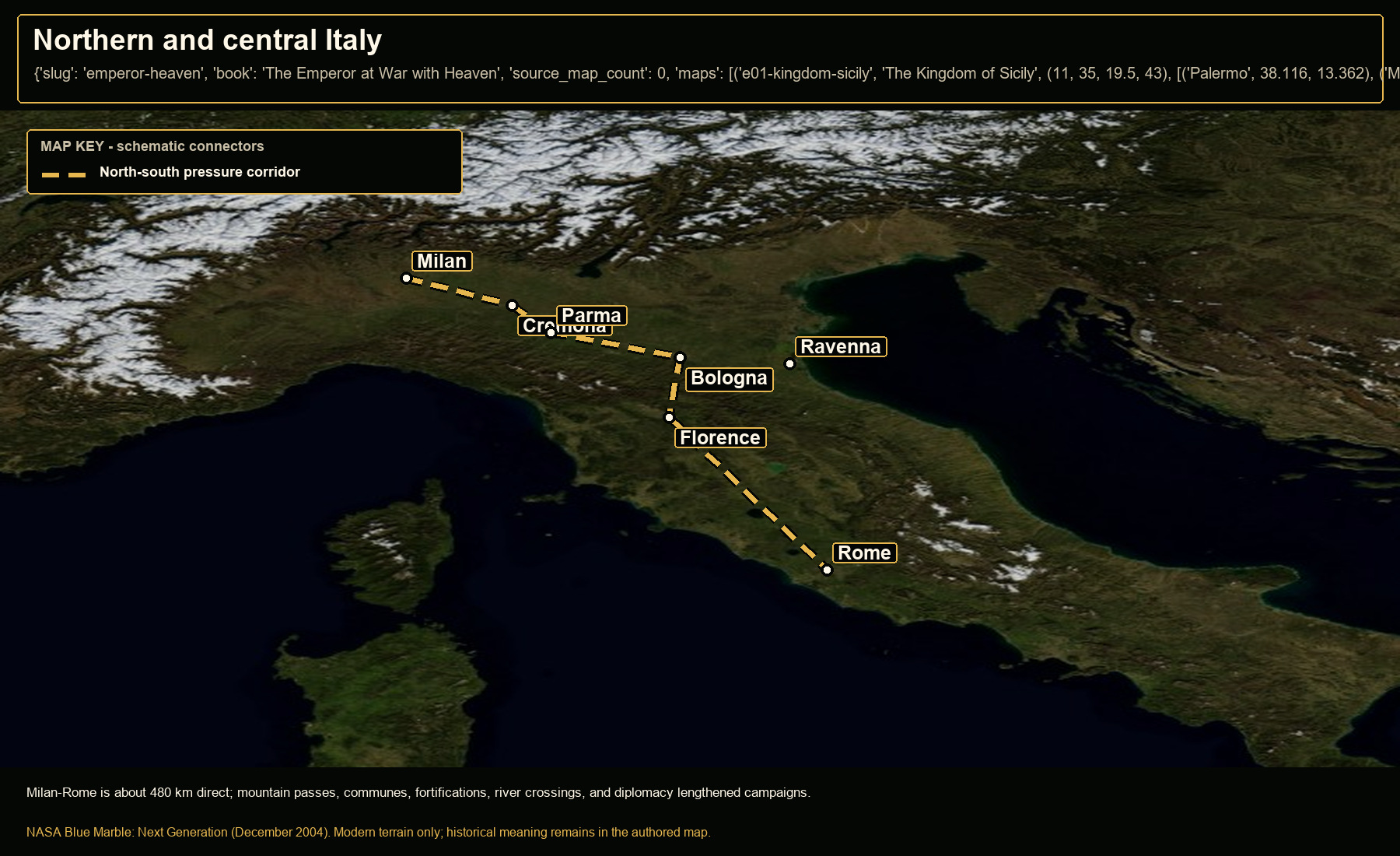
Northern and central Italy

Open NASA satellite orientation map: Northern and central Italy
new geographic coverage for an unmapped book

Milan-Rome is about 480 km direct; mountain passes, communes, fortifications, river crossings, and diplomacy lengthened campaigns.

Places
Milan · Cremona · Parma · Bologna · Ravenna · Florence · Rome
Route status
North-south pressure corridor: strategic relationship; routes varied
Crop
6, 39.5, 17, 47.5 (west, south, east, north)
04

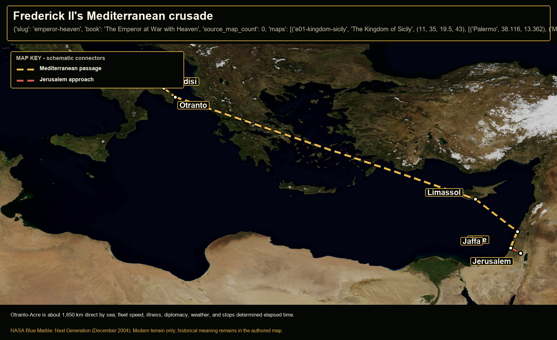
Frederick II's Mediterranean crusade

Open NASA satellite orientation map: Frederick II's Mediterranean crusade
new geographic coverage for an unmapped book

Otranto-Acre is about 1,650 km direct by sea; fleet speed, illness, diplomacy, weather, and stops determined elapsed time.

Places
Brindisi · Otranto · Limassol · Acre · Jaffa · Jerusalem
Route status
Mediterranean passage: attested ports; schematic sea connectors · Jerusalem approach: schematic land connection
Crop
10, 29, 37, 43 (west, south, east, north)
05

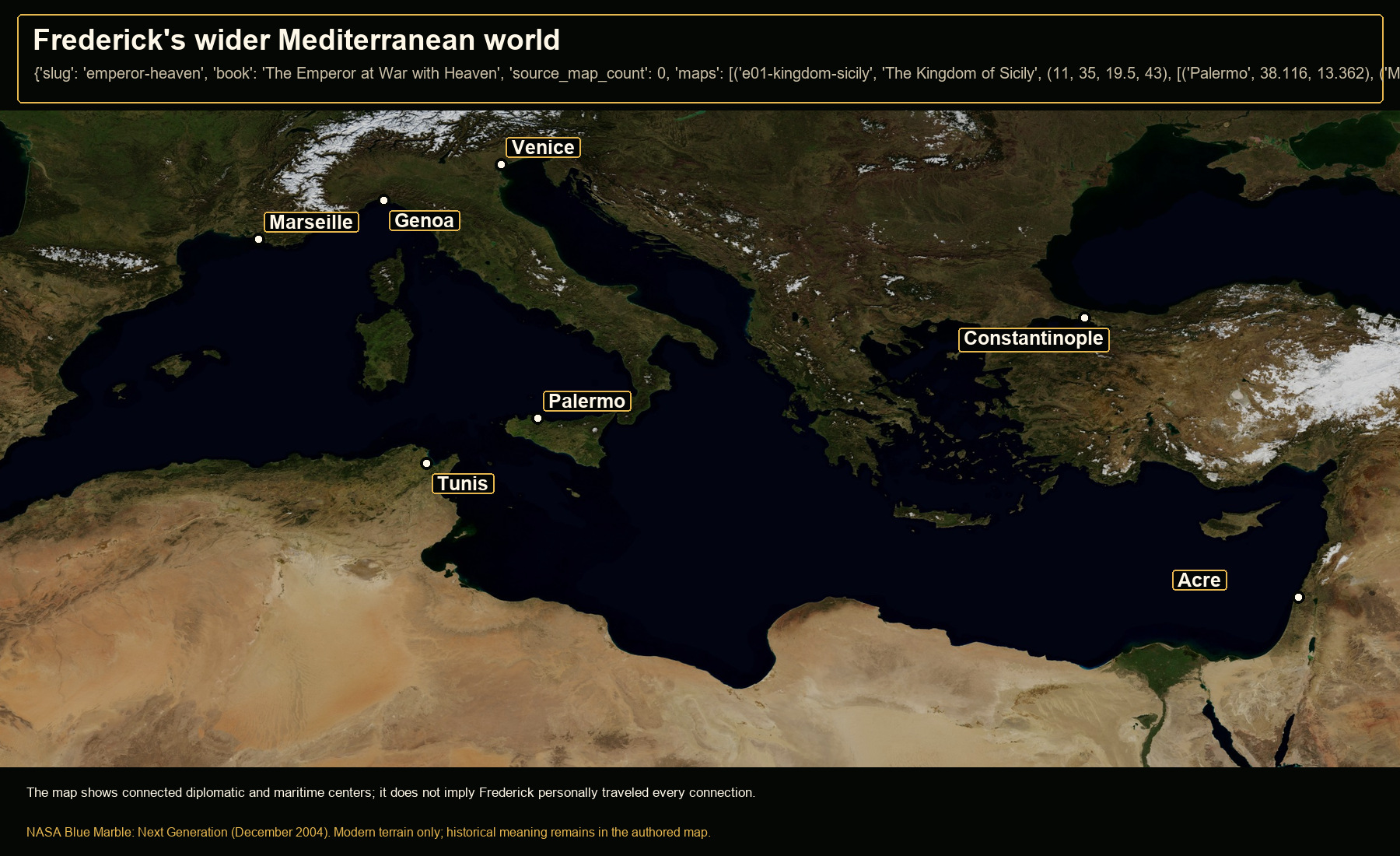
Frederick's wider Mediterranean world

Open NASA satellite orientation map: Frederick's wider Mediterranean world
new geographic coverage for an unmapped book

The map shows connected diplomatic and maritime centers; it does not imply Frederick personally traveled every connection.

Places
Palermo · Tunis · Marseille · Genoa · Venice · Constantinople · Acre
Crop
-2, 28, 38, 47 (west, south, east, north)
06

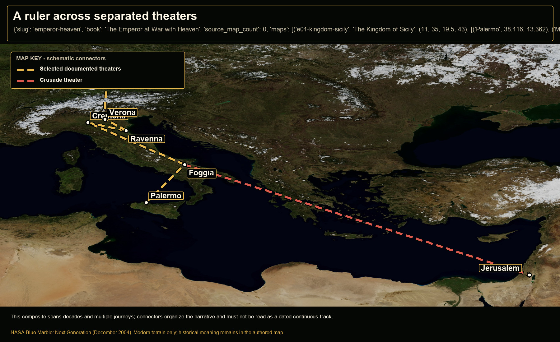
A ruler across separated theaters

Open NASA satellite orientation map: A ruler across separated theaters
new geographic coverage for an unmapped book

This composite spans decades and multiple journeys; connectors organize the narrative and must not be read as a dated continuous track.

Places
Palermo · Foggia · Cremona · Ravenna · Verona · Nuremberg · Jerusalem
Route status
Selected documented theaters: composite chronology; not one journey · Crusade theater: separate sea-and-land campaign relationship
Crop
5, 29, 37, 52 (west, south, east, north)

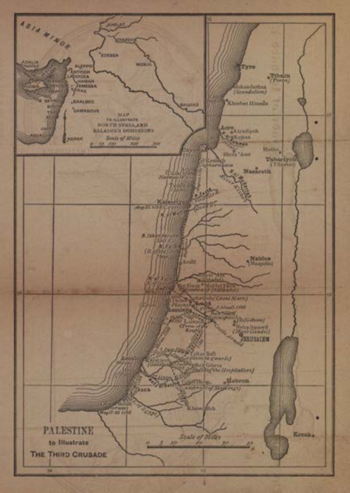
Repaired historical source

Archer's 1888 Palestine plate, upright and intact.

The shelf EPUB had an objectively inverted plate. It was replaced from an intact public-domain Internet Archive scan, then rotated for legibility without redrawing or generative reconstruction.

Palestine to illustrate the Third Crusade, an 1888 historical map restored to correct orientation

Source and method

A reproducible map record, not a visual guess.

Imagery. NASA Blue Marble: Next Generation, December 2004. The source file, URL, SHA-256 checksum, crop bounds, plotted coordinates, output checksum, and transformations are retained in the publishing manifest.

Interpretation. Modern imagery supplies terrain orientation only; it does not prove historical routes or boundaries. Straight-line distances are orientation measures; historical travel depended on road, terrain, water, weather, season, baggage, security, political permission, and waiting.

Use. NASA is credited as the imagery source and does not endorse this edition. Historical routes, labels, keys, travel notes, and uncertainty language are separate Zyel editorial overlays.

No email is required to view or download the map room. The optional home-study signup on the main site always includes a “No thanks” path.